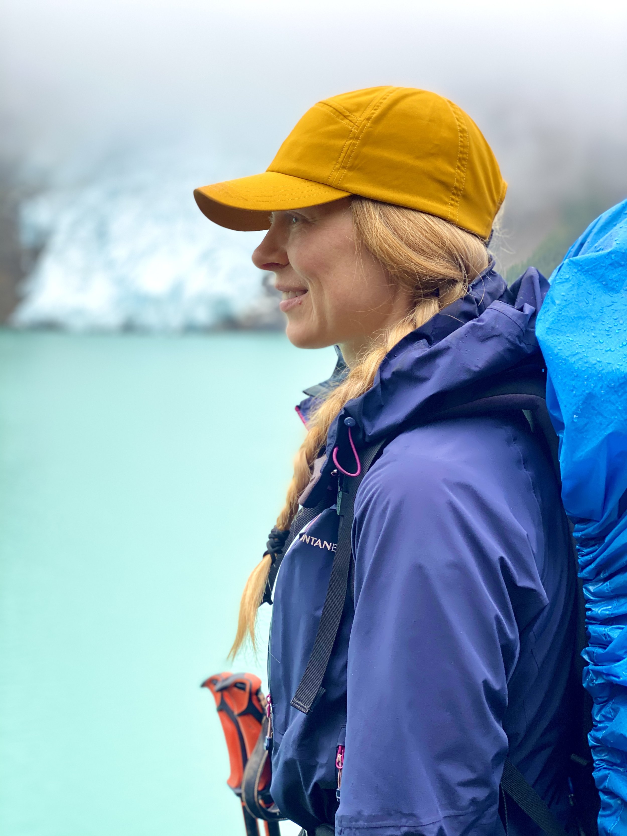
GREAT DIVIDE TRAIL - Section F
Jasper to Mount Robson Visitor Centre
Over the final 129 km section, Brian and Krysta feel more remote than ever. The nearly imperceptible trail carries them away from Jasper and through many, many kilometers of mud. After river fords and more mud, the trail climbs into the alpine for the final stretch of our journey on the GDT.
Distance: 129 km
Days: 5 days
Dates: September 2-6, 2020
Hiker(s): Krysta and Brian Norwick
Day 40: 36 km
Jasper to Miette River Campsite
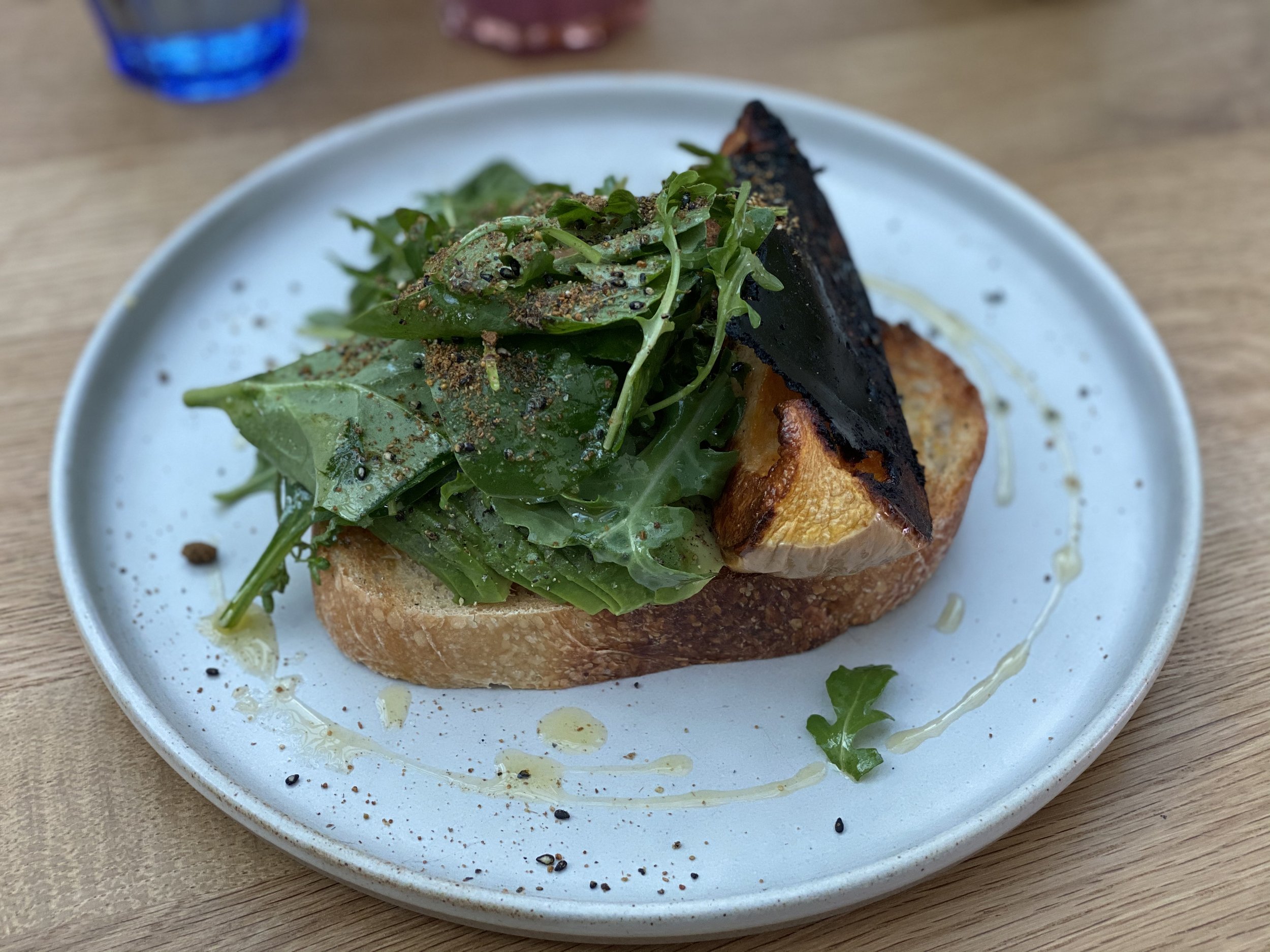
For the second morning in a row, we had a vegan feast at Sunhouse. We are so happy about this. The first 16 km out of town is on Highway 16. Nothing but big and loud cars whizzing by. Quick but boring walking.
Our amazing avocado toast at Sunhouse in Jasper. Highly recommended!
We turned right onto the Miette River trailhead, which isn’t a trailhead, but a gravel road. The road crosses the railway track and then turns West. The road ends at a small parking lot about 1 km in and this appears to be more of a trailhead. The next 4 km is relatively easy moving on an old road with a decent amount of mud.
We followed the GPS and a yellow marker in the tree to access the Miette River Trail off of the old road. The trail is quite overgrown with some blow down (but not nearly as bad as section D). We climbed over a couple switchbacks for about 300 vertical meters. Much of this section feels like you’re side hilling. It’s not amazing, but wayfinding is actually straightforward.
The trail then evens out for the next ~8 km. About 4 km in we had just cleared underneath a blown down tree when I rounded the corner in the trail and got within 4 feet of a Grizzly Bear’s butt. It didn’t seem too bothered and lazily jogged into the forest to the right of trail about 40 feet to resume eating. I immediately readied the bear spray and took charge.
We both backed up slowly until we felt there was a comfortable distance between us and the bear. I was reassured that the bear seemed ambivalent and not aggressive at all. Brian held the bear spray and readied for a charge while I prepped a bear banger. I quickly reminded Brian what to do if the bear took him down to the ground and asked if he was ready. Yes. I lit off the bear banger right above our heads and it exploded with ferocity.
Once the ringing subsided in our ears, we could no longer hear the bear rustling in the woods. I instructed Brian to continuously call out while I prepped another banger and then banged my poles together. We moved as a unit slowly towards where the bear had been. There were no signs of it, so we continued on as a noisy duo.
The final 4 km to camp we remained noisy and vigilant. We were a bit surprised by how close the bear let us get, but both very happy it was relaxed and not aggressive.
Camp is a small flat spot near a stream. A couple logs to sit on. We ate our vegan mac n’ cheeze, drank our tea, hung our bear rope and crawled into our cozy beds. It was good to debrief the bear incident and help each other calm our minds to get to sleep.
Cozy at camp.
Day 41: 25 km from Miette River Campsite to Colonel Pass Campsite
We both slept through the alarm. We must have been tired after our big day yesterday. We had lovely coffee with oat milk I had secretly carried in. We finally got going at 10:30 a.m.
The first 4 km took us 1.5 hours. I was leading and moving slowly to avoid walking directly in the mud. When we stopped for a snack and realized our pace, we knew we needed to pick it up in order to make our objective today. We decided we would stomp right through the mud moving forwards.
The first few steps were awful, sinking passed our ankles in soppy mud. But eventually we got somewhat used to it. For the entire 11.4 km of the start of the day until gaining Miette/Centre Pass the mud was consistently awful.
Mud on the Great Divide Trail.
After the pass the trail all but disappears and route finding commences through the alpine meadow for 2 km. We followed GPS track and eventually found a perceptible trail again. It was around this time that the mud got bad again.
Over the next 5-6 km to Grant Pass the trail was a bit easier to follow. We sank to our knees in mud at times and forded several creeks and streams.
After gaining Grant Pass we were finally rewarded with some views of the glacier. The mud remained. We trudged the final 4 km in the mud to camp.
Today was tough both mentally and physically. Trudging through mud will zap your energy from wet, cold and dirty feet to the energy it takes to push each step out of the mud. We were grateful for a small tarn at camp to rinse our feet and warm sleeping bags. I set up the beds while Brian did the cooking and water purifying. We make a great team.
The weather seemed to match my mood today – gray and dreary. I am feeling melancholy from the changing seasons both the weather and in my life. I don’t feel ready for the trail to end. But I also feel excited for the next chapter of our lives! I know with this hike ending it doesn’t mark the end of an adventure, but the start of a new one. The start of a lifestyle that revolves around outdoor adventure and expedition. It excites us both.
Day 42: 26 km
Colonel Pass to Slide Lake (Horse Camp)
We gained the 150 m to Colonel Pass quickly. It wasn’t too muddy and the trail was easy to follow. We then dropped down 500 m over 6 km into the Moose River Valley. The forest was previously burnt which allowed for more open views and a drier trail (yay!). We did have to contend with quite a few blow downs and some short trail re-routes.
Once in the Moose River Valley we essentially stayed close to the river for 16 km. The trail was sometimes challenging to follow, but the GPS track always eventually led us back to a discernible trail. We had to ford Moose River and its side streams many times (~20). The feet were soggy and wet all day.
Travel in the Moose River Valley was slow and muddy.
We saw many bear paw prints in the valley. We were calling out often to the bears. The soggy feet and relentless bugs make it difficult to want to keep pushing. We opted to stop for lunch at Colonel Creek campsite and make ourselves a second coffee. We needed this energy boost.
Once reaching the end of the valley, we started our final ascent towards Slide Lake and Moose Pass. We passed Steepe Creek Campsite which seemed like a good spot to camp, although very buggy. The climb to Slide was 300 vertical metres over 5 km. Mostly we could follow the trail and there was some nice clear signage at times. We did need to do a splash of route finding a couple times, but the final km to camp was clear and cruisey.
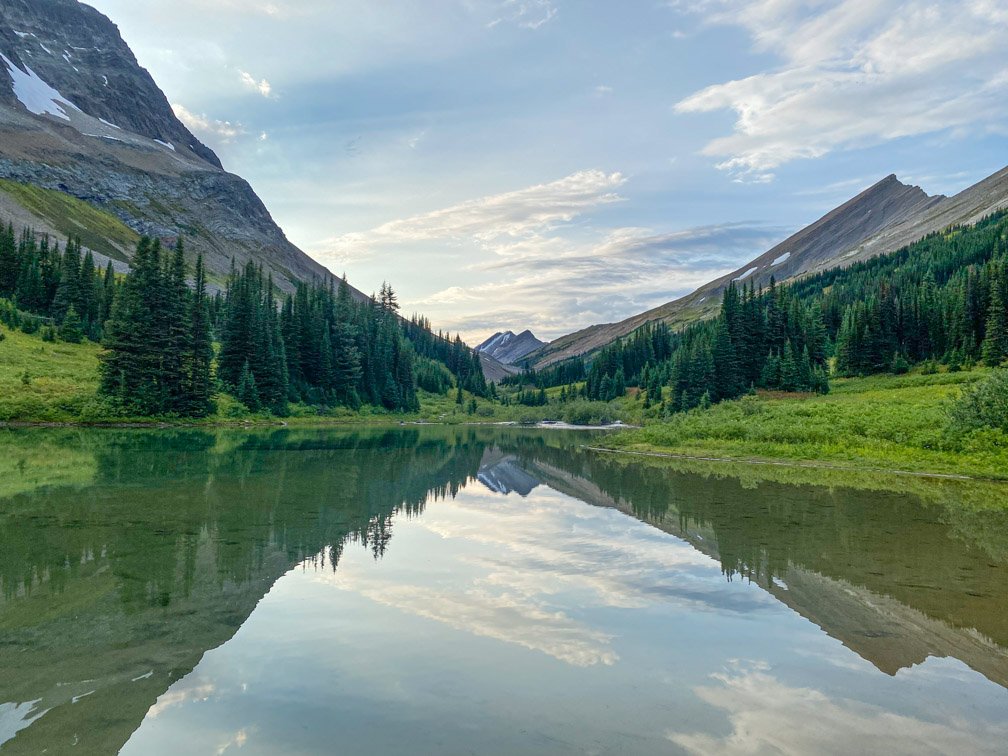
Slide is a nice little spot. Still buggy, but not as bad. You are nestled in just above the lake and have a beautiful view of Steepe Glacier. The rushing rivers are soothing to fall asleep.
Slide Camp.
Day 43: 16 km
Slide to Adolphus Campsite
I had a dream that I was eating roast beef and gravy at an all-you-can-eat buffet last night. I must be really hungry, because I don’t even eat meat.
I popped out of bed this morning. I slept well. I made us coffee and we each had 2 granola bars and 2 fruit leathers for breakfast. We are getting quicker at breaking camp despite the coffee in bed ritual.
Brian and I climbing towards Moose Pass.
The first ~ 5 km climbed steadily but gently towards Moose Pass. This is an incredible section of trail. The route finding is easy, the alpine views rewarding, and the meadow was in bloom. Even the bugs decided to leave us mostly alone. We climbed a total of ~300 m to gain the pass. The crazy steep contour lines on Gaia were incorrect, it is a gentle climb to the pass.
When we rounded the corner off the pass a huge mountain vista opened up before our tired eyes. I wept with joy. This moment truly felt like I’ve been on a pilgrimage this entire time to get to this raw and rugged moment. Unwashed skin, stained clothing, mud-infused shoes, strong muscles, empty stomach, cleansed soul, full heart. Grit was required beyond anything I imagined. I surprised even myself over and over again.
Moved to tears by Moose Pass.
The climb down from Moose Pass was easy, the only hard part was the hunger Brian and I were both experiencing was starting to make us a bit delirious. We were giggling uncontrollably at times.
Once in the Calumet Creek valley the trail turns slightly SW towards the Smoky River Ford. This is a notorious ford that we had been hearing about for weeks. We hit the river around 2 p.m. in the afternoon and the depth only came to mid-thigh. The water was strong and cold, but we successfully made it across.
Krysta finishing the Smoky River ford.
The final 2 km to Adolphus Campsite stayed on the right side of the Smoky River. The moving was easy. The peek-a-boo views of Robson in the clouds were spectacular. The campsite was surprisingly busy. We hunkered into our tent to avoid the mist and eventually ventured out to eat what was left of our food supply.
We went to sleep hungry.
Our first glimpses of Mount Robson.
Day 44: 26 km
Adolphus to Mount Robson Visitor Centre – The End
We had a dream of waking up in time for sunrise and watching the first light hit the magisterial Mount Robson. When our alarm went off it was pouring rain on us. We pressed snooze knowing a sunrise was not in the cards for us on our final day.
I must admit, I was grumpy this morning. In some ways this day had come so quickly and in other ways it feels like all I know is the trail. I did not want it to end.
Our morning routine had become so second nature that we could anticipate each other’s movements without even speaking. I stuffed our soggy wet tent into the tent bag without a worry of setting it up wet tonight. What an odd feeling.
The bear hang at Adolphus Camp.
We brushed up against dew covered grass and alpine shrubs as moved through the morning mist. The magnetic force of Mount Robson drew us ever closer. We walked in silence. No other hikers were up yet.
Mud on the Great Divide Trail.
We were drawn to the massive Mount Robson.
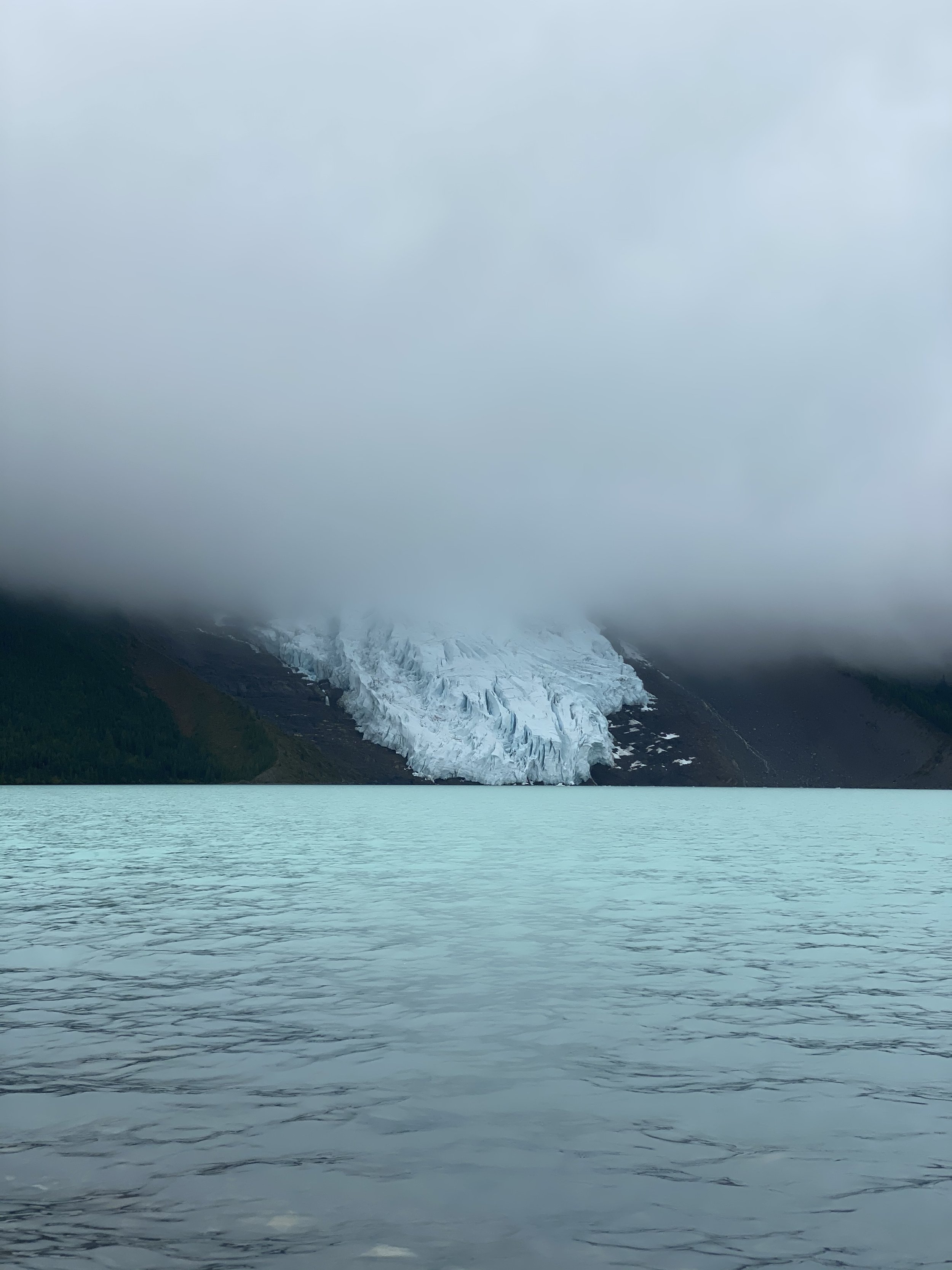
We arrived at the shores of Berg Lake and found beautiful hand-crafted benches to sit on while I brewed us our morning coffee. I felt tears pricking at my eyes as I watched the clouds encircle the peak and move along the glacier.
I couldn’t believe this was the end.
Hand-crafted benches overlooking Berg Lake.
I said to Brian as we sipped our coffee that I was surprised that although I was sad it was finished, I actually felt like I was ready. This section was so tough mentally with muddy feet all day every day and too many river fords to count. The human body craves hot showers and dry feet eventually.
After wrapping up our coffee we hit the well-maintained and well-marked trail to make our way towards the trailhead. This final 20 km of trail are easy moving and mostly downhill. This is a nice chill end to a massive hike. We passed many other day hikers, trail runners and multi-day hikers. When we told some people where we had come from (Krysta all the way from Waterton!) we got cheers and congrats. It felt like we were really accomplishing something great.
About 5 km from the finish when we arrived at Kinney Lake we came across Brian’s Uncle & Aunt who had arranged to meet us for lunch. They brought a feast and Brian and I ate quickly. Our hunger satiated at last. There is a nice little shelter for lunch along the lakeshore, which was a great break from the rain that had started earlier in the day.
The final 4 km to the trailhead was along a lovely graded path. This is smooth walking and even allows bikes. It was a nice change to walk these kilometers with two other people and share some of the harrowing stories from this section. The foliage was lush, and I truly felt like I was arriving home to BC.
At the trailhead our hiking companions got in their car while Brian and I held hands, determined to finish the last 1.5 km on foot to the visitor center.
I started this journey alone in a dry and hot landscape. I suffered from heartache missing my husband and heat exhaustion most days in the first section. I settled into myself and the trail as I made my way to the halfway point, growing stronger physically and mentally every day. I finally let go of my mental blocks and learned to love myself unconditionally. At the halfway point, Brian joined me, and we had to learn what this journey together would mean. After many stumbles in our first two weeks together and multiple conversations that lead to one or both of us collapsing into tears, we finally felt like a strong unit again. Our communication became clearer and we settled into a rhythm that worked for us both. We shared the incredible moments with each other, which made them all the more magical. We also shared the tough moments, which made them easier to bear.
My journey became our journey.
We walked towards togetherness and independence as we walked ~400 kms to Mount Robson. This was a special honeymoon that both of us needed for different reasons.
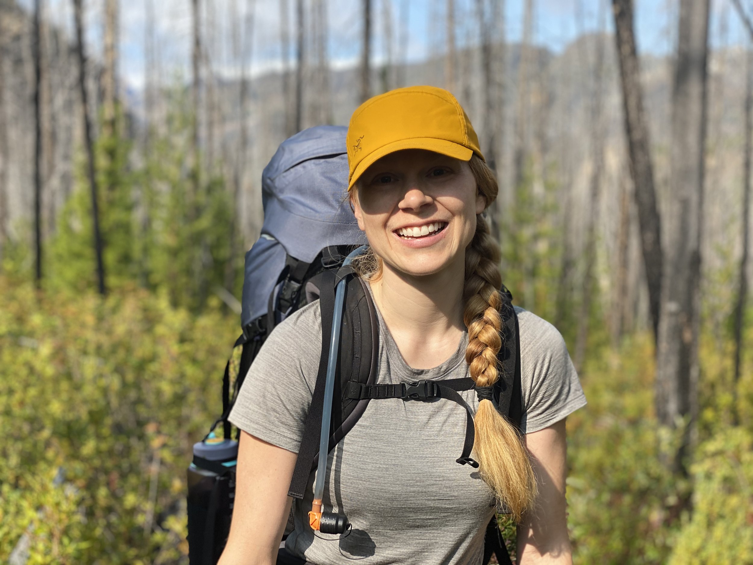
Brian and I the moment we finished trail.
As we stepped into our new 60 square foot home, we felt excited butterflies for the next chapter in our lives. We also felt this calm settle over us as we consolidated our journey.
Now, to eat.
Driving us to food and our next chapter, together.
Equipment Used:
Tent: MSR Hubba Hubba
Backpack: Arc’teryx Bora AR 61 Backpack
Women’sHiking Shoes: Salomon Women’s Outbound Hiking Shoes
Sleeping Pad: Therm-a-Rest NeoAir XTherm MAX Ultralight
Sleeping Bag: Mountain Hardwear Lamina Synthetic Sleeping Bag -18C
Pillow: Sea to Summit Aeros Pillow
Garmin inReach
Gortex Jacket: Montane Women’s Alpine Pro Jacket
Down Jacket: Montane Women’s Phoenix Jacket
Smartwool Longsleeve
Smartwool Shortsleeve
Smartwool Underwear
Fuel
Laundry Soap
