GREAT DIVIDE TRAIL - Section E
Saskatchewan River Crossing to Jasper
This 168 km section of the GDT climbs directly into the alpine just North of Saskatchewan River Crossing. The next eight days were spent together almost exclusively in the alpine. Brian and Krysta took the 6 Passes Alternate route.
Distance: 168 km
Days: 8 days
Dates: August 23-31, 2020
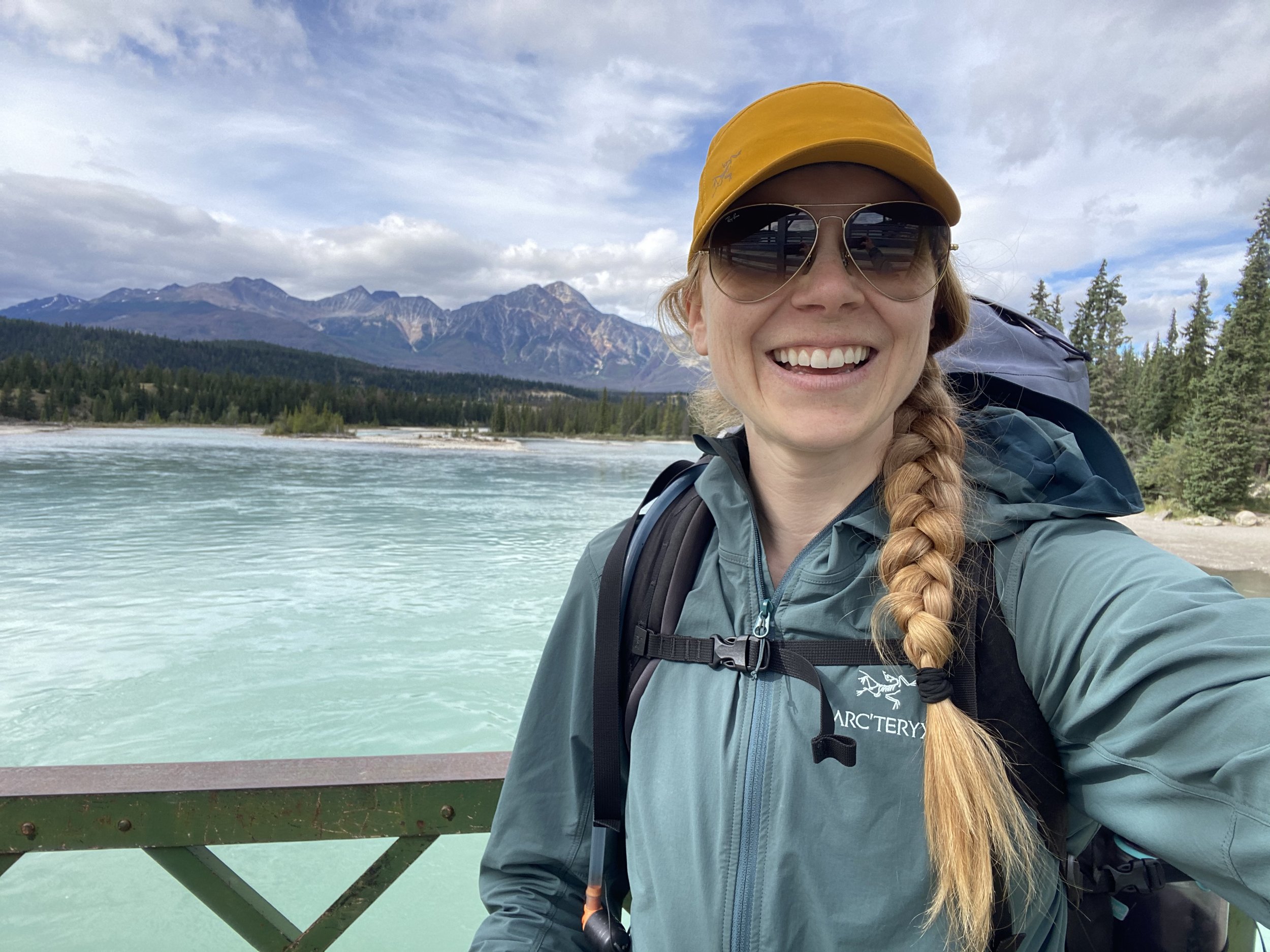
Hiker(s): Krysta and Brian Norwick
Day 30: 6 km “rest” day
Saskatchewan River Crossing to Random Camp
We slept in and then headed back on trail in the afternoon. The first 1.5 km were back along the highway. We found the GDT just before the bridge across the Saskatchewan River (west side of the river). There are no trail markers, so we used our GPS. The trail seems to utilize an old rail grade near the bank of the river. We stayed on this for 4.5 km until reaching Owen’s Creek. There is an old log cabin here and a log across the creek. We crossed the log and set up camp on the East side of the creek. There are many flat spots here for tents. We rested and dried out our laundry for the rest of the day.

Our cute little camp spot.

Delicious red Thai curry meal by the creek.
Day 31: 25 km
Random Camp to Pinto Lake Campsite
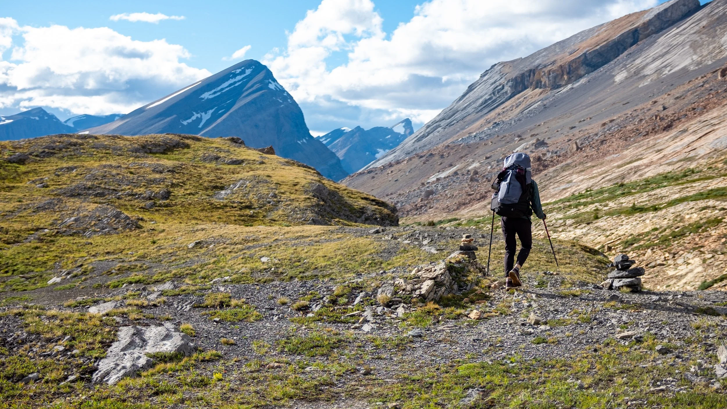
We started off hiking 0.5 km to the Owens Creek Trailhead. This was a relatively well marked trail that climbed ~1,000 vertical meters over about 10 km. We enjoyed the climb and the alpine urged us towards the stunning views at the top of the pass.
We gained Owen’s Pass and then the trail quickly dropped down to the two beautiful lakes (Michelle Lakes) for our lunch break at 1 pm. The rain moved in and I got quite cold. We ate quickly.

Michelle Lakes along the Great Divide Trail.

Krysta above Michelle Lakes.
We gained the next pass at a good pace and got to the highest point of the GDT!!! It was a bit of a surreal feeling! We dropped down quickly again to get out of the wind. The descent is a bit loose and it was muddy due to the rain. It was hard to find trail and it seemed mostly to be a route. We dropped down towards Waterfalls Creek. Keep an eye for orange flagging tape along the creek which marks the start of the trail up to Pinto Pass.
Pinto Pass trail is easy to follow and a decent climb up about 300 meters. The mud made it more challenging, but we were still able to make the climb with good time. Once out of the trees we were in alpine meadow. Climb towards the obvious saddle marked with cairns.
From Pinto Pass we dropped down on the muddy slope for 150 m. We dropped to the creek and then realized trail was to our right ~50m. We rejoined trail and it was pretty wet and muddy, but still easier moving than beside the creek. The trail drops down to Pinto Creek campground.
From here the trail drops another 200 m through forest and across Pinto Creek. You arrive at Pinto Lake on the south end and make your way North along the East shore. You can camp at East Pinto or continue to North Pinto camp. We opted to continue and ford the final broad creek just before camp. It was busy at North Pinto with lots of people building fires. We opted for a forested spot away from the smoke. Hoping we don’t wake up too damp in the morning!
Day 32: 28 km
Pinto Lake to Boulder Creek Camp
We were both feeling low this morning with cold and wet feet and just not feeling in sync.

Beautiful Pinto Lake in the morning.
The first 4 km meandered through the wetlands North of Pinto Lake. The trail was relatively well marked until the Alberta Parks Boundary at Huntington Creek. Yes, you do have to ford Huntington Creek.
From here the trail was tough to follow for about 1 km. You do have to ford Cataract Creek as well. After this point, the trail is easier to follow and snakes its way up on the right (North) side of Cataract Creek.
I started to feel drained and when we had to ford another small creek, my morale dropped dramatically. We stopped in the sun to dry out our feet and eat some peanut butter wraps. This helped.
We walked along Cataract Creek for ~7 km until the trail started to climb up towards Cataract Pass campsite. At the campsite the trail becomes hard to follow again. We stuck along the right side of Cataract Creek until we were forced to ford. Thankfully this was the final ford of the day. We were able to stay left of the creek after this point. The trail is marked with a few cairns, but route finding is important here. After about 3 km along the creek, we left the creek edge to start towards the pass.

Incredible landscape leading up to the pass.
The climbing up the pass was pretty well marked with cairns and some tough climbing. There was loose rock to contend with and the wind was picking up. It seemed like someone had cleared the route of the big loose rocks, which was lovely!

Halfway up the climb to the pass we passed the 700 km mark!!!
Gaining the pass was a huge milestone in our day! I had another long break feeling like the day was just dragging on too long and I didn’t have enough food to fuel it!

Brian navigating the rocks.
The drop down was quite smooth. The route again seemed cleared and we were able to jog down. The views were out of this world good!! We were giddy! Worth the push through the pass!!

Incredible views.


We dropped down to the valley below (150m). We hiked right of Brazeau River for the next 4 km and again the route was relatively easy to follow.There is a sign at the junction with the Nigel Pass route and the traveling gets even easier from there. You climb less than 50 vertical meters to get just about Brazeau River and then drop down towards Boulder Creek over the next 2 km. The views are again incredible and the landscape so interesting.
We crossed a BRIDGE (!!) 200 m south of Boulder Creek camp. Arrived late so set up, ate, tea, chores and bed!!
Day 33: 28 km
Boulder Creek to Waterfalls Campground
As soon as we woke up the rain started. Brian made us coffee and organized our outside tasks while I lingered in bed after a restless sleep.
We got going at 9:30 a.m. and the first 2 km along Brazeau River were very chill. Just after passing Four Point campground we stayed left at a fork in the trail to head towards Jonas Pass.

Krysta is all smiles on Jonas Pass.
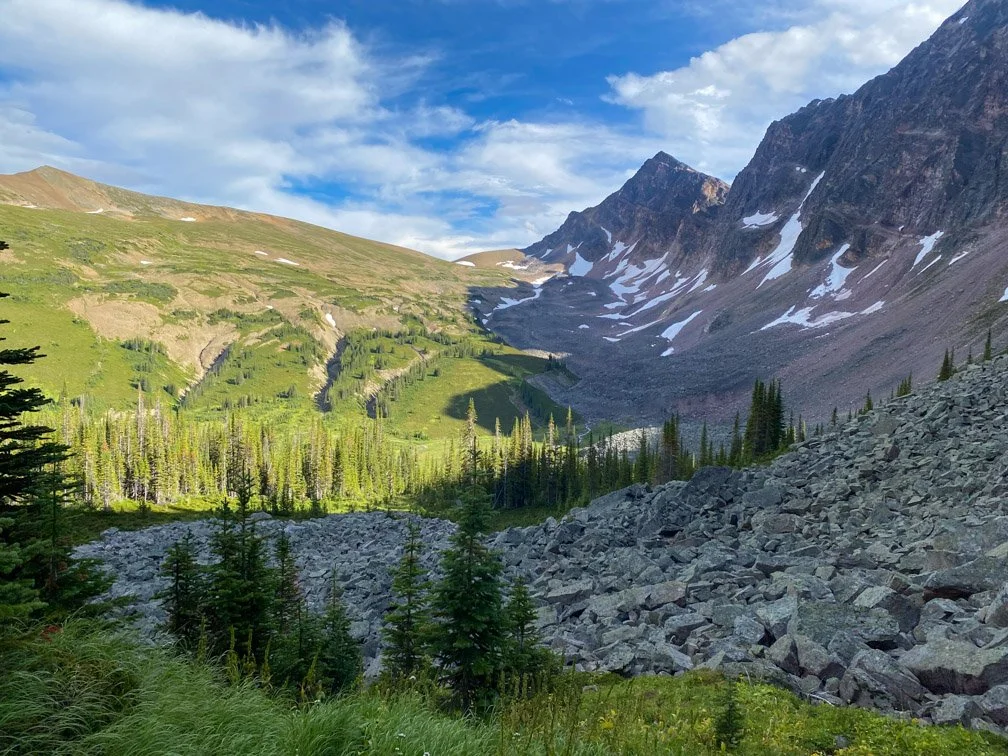
We initially climbed 100 vertical meters to gain a bit higher ground left of Four Point Creek. The trail levels out and very gently climbs over the next 7-8 km. Eventually you walk into this stunning alpine meadow as you continue to make your way to Jonas Pass. It was incredible.
Jonas Pass was our lunch stop at 12:30 p.m. The trail then gently drops ~100 m before climbing again to Jonas Shoulder. The way finding is easy and the climb not too steep. We gained 300 m through meadow to rock. The views were amazing.
The drop down on the other side was clearly marked and easy to follow. We dropped 350 m quickly. We passed Jonas Cutoff Campground and a hundred meters afterwards there was a beautiful bridge across a stream. Another great spot for a break!
The final 8 km to Waterfalls Campground followed the right side of the stream. It mostly gentle descent and was quite cruisey. We were happy to get to camp early!
Day 34: 24 km
Waterfalls to 6 Passes Alternate – the first valley
The first 4 km of the day the GDT followed a well-maintained trail with just a bit of mud from the rain. The bridges were great.
After Poboktan we took a right at the fork to continue on towards Avalanche. The trail is a bit less maintained in this section with a few bridges being washed out. We managed to cross all streams but one without fording. We chose to switch to our Birkenstock rubber sandals and they worked great for the crossing. It was about 6 km to Avalanche.
We stayed right at the fork at Avalanche and the trail continues to climb gently for 200 m over 4 km into a phenomenal alpine meadow. I was in awe. This was one of my favourite moments of the entire trail. Everything about this place spoke to my soul. I just felt like I belonged. There was a beautiful alpine lake that we cooled ourselves off in.


Absolutely in awe of this landscape.
The fork for the 6 Passes Alternate Route is not obvious. You will need wayfinding skills. The Guthook GPS track worked great. The fork is on the North end of the beautiful tarn.
You gain the small ridge Northwest of the tarn and make your way to the first mountain pass of 6 passes. After ~100 m the terrain changes from green shrubs to exposed rock. We picked our way climbers left up the shale to gain the saddle just left of the snow. This was 200 m of kicked in steps in a switchback pattern. There is no trail here, so we were making our own.
Once at the saddle we were looking back at 4 beautiful tarns and looking forward towards our alpine meadow for the evening.

Brian and Krysta all smiles on the start of 6 Passes Alternate.
The drop down is again on shale, but each step only slides a little, allowing us to jog down the slope. We continued dropping 500 meters over the next 5 km. Again, creating our route as there is no trail. We followed what seemed to be the most obvious path and picked our way through rocks, shrubs, muddy and damp grass, hopped over small streams and eventually reached the end of the meadow.
We set up camp on the east side of the meadow on some higher ground. We were able to find a great tree to hang our food. We had to contend with the very thirsty mosquitoes all evening, so got cozy in the tent as quickly as we could.

Our camp for the first night on the 6 Passes Alternate.
Today was my favorite day on the GDT yet. The trail, the views, the swim, the sharing with my love, the adventure of an unmarked route and feeling confident in our route-finding skills and nestling into an alpine meadow for the night. Pure magic.
Day 35: 13 km on 6 Passes Alternate
Hiked 4 passes to the two tarns halfway up the sixth pass
Our day began from the end of the meadow between the first and second passes. We slept in until 7 a.m., allowing time for the sun to sneak over the ridge and bathe our frosty tent in warmth.
We got going at 10 a.m. The final 0.5 km of the meadow required a river ford. This was shallow and slow moving, so we elected to remove our hiking shoes. The gain to pass 2 was straightforward and not too steep. We picked our way up the east side of the slope to gain the ridge before the saddle. Then slowly up to the saddle. It was a wonderful sight to turn around and see when we had come from.

Brian gaining our first mountain pass away from camp.
We dropped NW off the saddle towards the valley below. We dropped 200 vertical meters towards the stream in the middle. We decided to gain towards the next pass by staying just climbers right of the most western tree band. We were able to gently gain this ridge and then turn NE and follow this ridge towards the saddle. We then turned to go straight up the slope climbers right of the snow patches.

The view from the second mountain pass of the day.
Upon gaining the saddle we stopped for lunch, hydration, bandaging blisters and Krysta’s left collarbone.
We dropped down off the rocky saddle and veered to our right to walk onto a green ridge line we were able to follow all the way down to the valley.

The green ridge we descended.
We gained towards the third pass below the SE bowl of Sympathy Peak. Once just below the rock field, we turned right and climbed through trees and then crossed a smaller boulder field. We continue upward through the trees for ~ 75 vertical meters before turning right again to cross a larger boulder field. From there we were able to climb straight up towards the saddle skirting some small trees, more rocks and some loose shale. This was the toughest of today’s mountain passes.

The view looking back from the third pass of the day.

The view looking forward from the third pass.
At the saddle we descended down the broad shale covered slope towards the valley. We stayed along a sloped ridge to our right off the saddle that carried us down towards the stream below. We had to do a minimal amount of bushwhacking for ~ 100 vertical meters of descent to get to the stream.

Beautiful wildflowers dropping into the valley.
The stream can be crossed without fording and it was a nice spot for a snack break.
From here we made our way towards our fourth pass of the day. We bushwhacked for ~15 meters up from the stream. We then noticed a dried-up drainage that we were able to follow for ~150 vertical meters of the climb (this was almost directly on the Guthook GPS route). This felt the most like a trail since we started 6 passes!! We then turned right to stay below the rock band until reaching a green and bushy section that we were able to follow to climb up to the saddle. This was our most straightforward pass of the day!

Happy loves at the fourth and final pass of the day!

On the final and broad saddle of the 4th pass.
Just down from the saddle we were able to spot the next ridge and the lovely tarn we were planning on camping at. Dropping down this time we stayed a bit more left and aimed towards the right side of the boulder field in the valley below. From above you can see where two streams join to head NE down the valley, creating a “Y” shape. As we descended, we aimed for this.

The view from the 4th pass of the day.
Once in the valley bottom we hopped over both streams (no fording required) and stayed on the North side of the second stream. We followed this up towards the rock wall and turned right into the trees after ~25m to avoid walking on rock. The rest of the climb we tried to stay just above tree line but below rock and we headed for the first tarn. This allowed for mostly easy traveling, but some forest travel was required. There was minimal bushwhacking through small trees.
The view looking South from our camp spot for the night.

Our second camp spot on 6 passes.
The trees thin as the climb rounds out and you catch your first glimpses of the tarn. Our plan was to camp here, and we are very glad it was! Such a stunning location all to ourselves! There are mountains all around, a tumbling waterfall into our lake and lots of flat spots for tents. The only thing missing are large enough trees for a bear hang. We hoped our rope between two trees would suffice for the evening! We haven’t seen signs of bears since leaving our camp in the first valley this morning.
This was Brian’s first alternate and he found today challenging. There was an underlying stress of the unknown and constant route finding. He enjoyed the adventurous side of it, but also found it emotional to always been so mentally on. However, over the course of the day we both felt more and more confident with our route-finding skills. It was honestly really fun to challenge ourselves and make our own trail!
Day 36: 13 km
6 Passes Alternate to Evelyn Creek Campsite
Our food was safe this morning! It poured rain on us throughout the early morning and started to turn to snow around 7 a.m. We opted to have coffee in the tent and try to stay as warm as we could while waiting for a weather window. Our Garmin inReach updated us with the current forecast and we deduced the window would be ~11-2ish. When the rain subsided, we got to packing. Fully packed and hiking by 10:30 a.m. with no rain and blue skies poking out.

Our view in the morning.
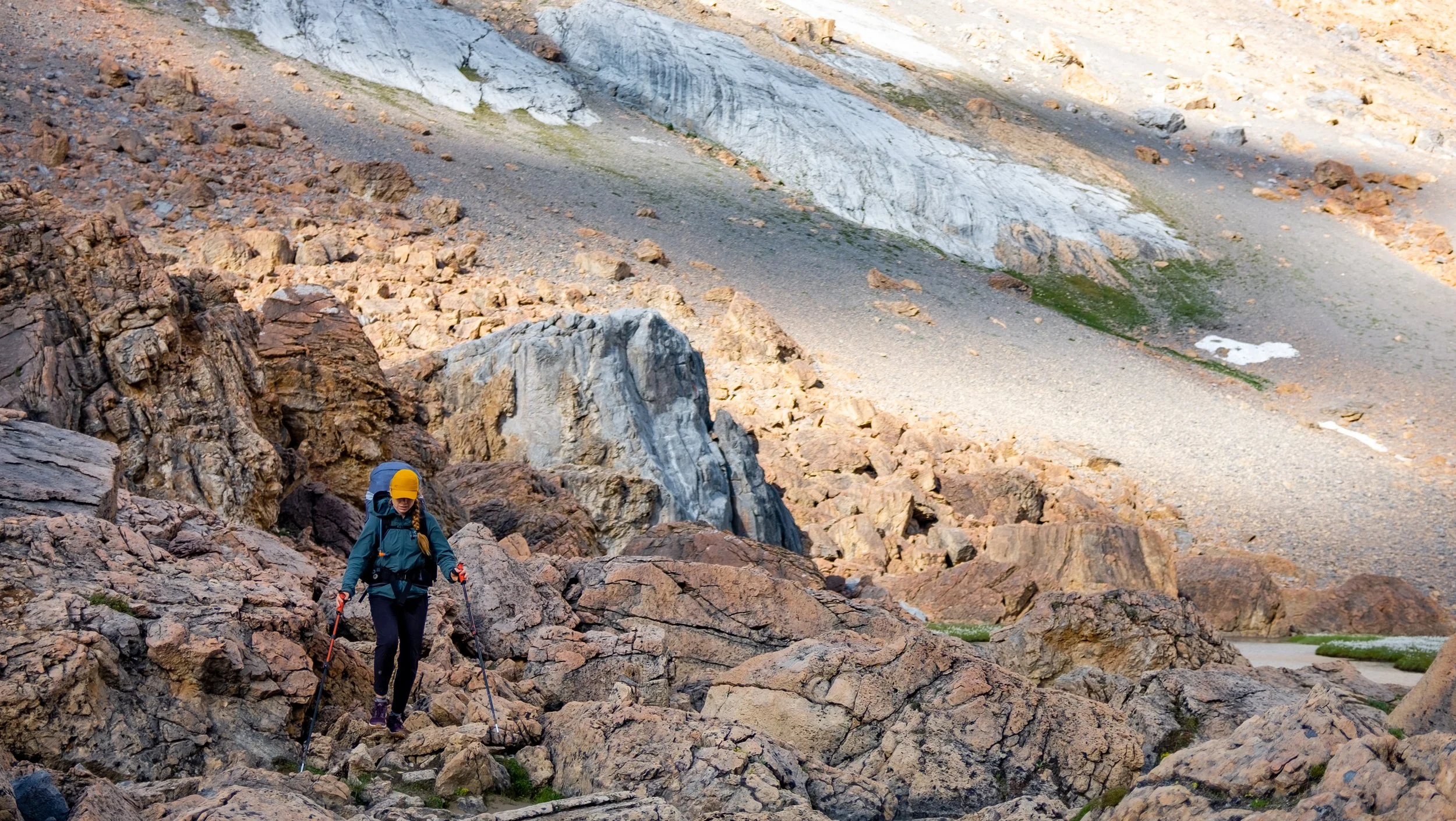
We hiked on the Eastern shore of the lake and crossed two streams and some swampy meadows. We made our way towards the East side (climbers right) of the visible rocky gouge close to the saddle. We then slowly turned up towards the top of the ridge and had to put in some switchbacks through snow covered rock to gain the final 150 m.
Once on the ridge, moving was a bit easier. We gained the highest point of the ridge at 2,500 vertical meters and marked by a large cairn. From the cairn we descended the East face of the summit in the direction of the ridge. This requires difficult scrambling for ~10 vertical meters. We were both able to do it with our packs on. After this short pitch of scrambling we dropped down watching our footing on the steep slope with some loose shale and rocks. We dropped ~200 vertical meters then slowly picked our way across the sharper spine of the ridge.

Hiking the spine just after the scramble off the summit.
Once across the sharp spine the ridge opens up and we were comfortable using our poles again and walking beside each other. This continues for ~2 km and then you arrive at another short climb in the ridge to access the bald hills. We climbed directly up this and put in a few switchbacks. Once on the other side it was like a whole new world!! Obvious trail, lots of day hikers, signage and no need for scrambling.

Poles on the backpack for hands-free scrambling.
We followed the Bald Hills Trail to the Evelyn/Skyline Trail to the Skyline Trail and Evelyn Creek Campground. What a lovely way to finish a remote and rugged route through 6 passes!!

Brian very happy to see trail signs!
Day 37: 40 km
Evelyn Creek Campsite to Signal Mountain Trailhead (Maligne Canyon Wilderness Kitchen)
5 am. Headlamp. Coffee making. Final wraps. Cuddles. Cold.
The trail started with gentle climbing up switchbacks. We were moving quick and feeling good. We made the first couple km to Little Shovel Campground quickly. After this, the climbing became steeper as we gained Little Shovel Pass. It was still early in the day and pretty cold, so we put our toques and gloves on. We dropped down from the 2250 m pass into a beautiful alpine meadow.
The next 10 km in the alpine was pretty cruisey and we continued to make good time. We then gained Shovel Pass by climbing ~250 vertical meters, but at a rate that was pretty comfortable.
We hugged contour line for ~2 km to the turn off for Curator Camp. First break here. We were really rationing our food by this point. While eating our Crunchy Little Lentils a bumblebee flew in. We had to very gently remove the bee and try not to lose any lentils!
The trail then heads towards the Notch around the North shore of Curator Lake. This 300 m climb is challenging. The trail is steep as it cuts through a boulder field and onto some loose rock to gain the saddle. The views are worth it. We were on the Skyline ridge for 5-6 km and drank in the mountain vistas on either side.

Skyline Trail.
Incredible Skyline Trail
We followed the obvious trail as it dropped down the Northeast side of the ridge towards 2 alpine tarns. We dropped 200 m along switchbacks. The trail leveled out for the final 2 km to Tekarra Campground. We drank water here and pushed on, hoping to find some food at the trailhead.


After crossing the stream, we climbed our final ascent gradually for 100 vertical meters. Our hunger was really starting to slow us down, but eventually we got our rhythm back as the trail flattened out and gently descended towards Signal Camp.
The single-track trail turns onto an old fire road as we descended the final 850 vertical meters over 8 km down to the trailhead. We walked to Maligne Canyon Restaurant for some well needed and well deserved sustenance.
Day 38: 12 km
Filia Inn in Jasper
I was not feeling good this morning. Neither of us were. After a bunch of tears, Brian cooked up our final dinner for brunch. We broke camp and made the short trek to Jasper. But man did this ever feel like a long trek! We were shattered and absolutely ravenous.
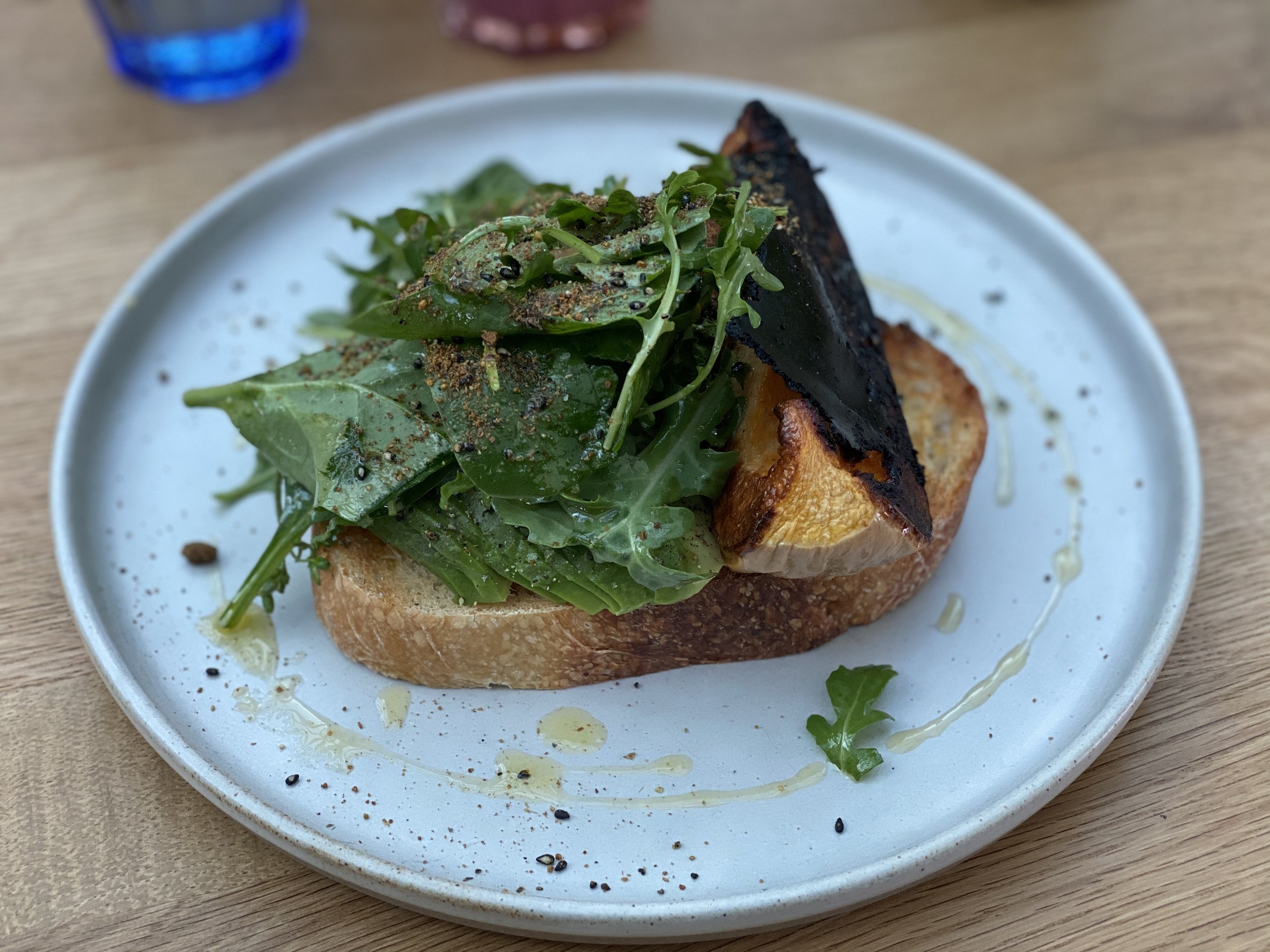
The trail seems to follow some bike paths / footpaths / horse trails. The main route was closed due to bear activity just East of Jasper Park Lodge. We took another trail instead, which sent us right to the Jasper Park Lodge. Brian made the correct executive decision for us to enter the lodge and look for coffee. We were super pleasantly surprised with several vegan options at their cafe, 6 types of smoothies and oat milk lattes! We sat on the beautiful balcony and enjoyed our feast. We were starting to feel human again.

The view from the Jasper Park Lodge deck.
The final 5 km to Jasper we utilized the walking paths of the lodge around the stunning Lac Beauvert. We then followed the Red Squirrel Trail to the Highway 16 junction, took the pedestrian tunnel under the tracks and walked into town! We checked in at the Filia Inn and felt immediately at home with the lovely personal touches by the owner Matt.
Crossing the final bridge to Jasper and so excited for all of the food!!!
Equipment Used:
Tent: MSR Hubba Hubba
Backpack: Arc’teryx Bora AR 61 Backpack
Women’sHiking Shoes: Salomon Women’s Outbound Hiking Shoes
Sleeping Pad: Therm-a-Rest NeoAir XTherm MAX Ultralight
Sleeping Bag: Mountain Hardwear Lamina Synthetic Sleeping Bag -18C
Pillow: Sea to Summit Aeros Pillow
Garmin inReach
Gortex Jacket: Montane Women’s Alpine Pro Jacket
Down Jacket: Montane Women’s Phoenix Jacket
Smartwool Longsleeve
Smartwool Shortsleeve
Smartwool Underwear
Fuel
Laundry Soap