GREAT DIVIDE TRAIL - Section D
Field to Saskatchewan River Crossing
Brian joins Krysta for the second half of the GDT. They start hiking from the Field Visitor Centre and take the regular GDT route all 106 km to Saskatchewan River Crossing. This section proves to be the most overgrown with the most challenging river fords in the Howse Floodplain.
Distance: 106 km
Days: 5 days
Dates: August 18-22, 2020
Hiker(s): Krysta and Brian Norwick
Day 25: 23 km
Field to Otto Creek Random Camp
We spent the night in our tiny home on wheels. We downloaded maps, organized some gear, ate some last-minute food and tried to sleep through the train noises.
We were up at 8 a.m. and started to pack and get organized. It took us a long time to sort through everything and ensure the van was okay to be left there for 3 weeks.

Brian in front of our van.
We got going at noon. The trail departs from the Field Visitor Centre and heads west on the north side of the highway. The trail crosses the highway after a few hundred meters and uses the Tally Ho Trail. This meanders through the forest towards the Natural Bridge attraction. There are washrooms and garbage here.
The trail then follows a closed logging road along the south side of the Kicking Horse River. All is smooth sailing until you cross the Amiskwi River and start the Amiskwi Pass Trail. The trail is quite overgrown, and we had to contend with ~100 blown down trees. It was slow moving.

Signage marking the Amiskwi Pass Trail.
We continued like this for ~12 km. Eventually the trail had less blowdown and it was a little less overgrown.

Krysta strolling on the Amiskwi Pass Trail.
We stopped at the beautiful Otto Creek and hunkered down for the evening. We are both feeling good and Brian is especially feeling great starting trail.
Day 26: 18 km
Otto Creek Random Camp to Amiskwi Pass Random Camp

Krysta hiking along Otto Creek.
We hit the trail and almost immediately were met with more blow down and bushwhacking. About 4 km into the day the bushwhacking got really bad. The brush was higher than our heads, thick and relentless. It slowed us right down. This persisted for 3-4 km.
We forded rivers three times today. At about 6 km into our day we forded the Amiskwi River and were able to do so in our sandals. After this river ford, the trail became better marked and much less overgrown. We were able to hike at a better pace. The trail climbs slowly and steadily, but we barely noticed.

Krysta taking in the views on Section D of the GDT.
The next Amiskwi ford was deeper and faster, so we elected to leave our hiking shoes on. The trail was more undulating here. Another 1.5 km of following flagging tape through the river valley to our final river ford, which we also kept our shoes on for. We stopped here to dry the socks and have our final snack.
The final 5 km climbed up to Amiskwi Pass. We enjoyed the views and the well-marked path. There were still wildflowers blooming as we entered the subalpine.

Stunning wildflowers leading up to Amiskwi Pass.
The Amiskwi Pass Campground had no water source, so we continued along the trail 1 km until we heard Ensign Creek bubbling. We found a flat spot in the flowers for our tent a short walk from the creek. The mosquitoes are terrible here and we are so thankful we have the head nets for the bugs. We had a nice meal of tagine and headed to bed by 7:30 p.m., mentally preparing for a bigger day tomorrow.
Day 27: 22 km
Amiskwi Pass Random Camp to Cairns Creek Camp (David Thompson Trailhead)
The first km of hiking was along a thin trail. After about one km the trail pops out onto a logging road. This meant for easy walking and navigating. We were told by other hikers that the Amiskwi Ridge Alternate that climbs up from this point is well worth the climb. Maybe we will do the alternate next time?

The views from the logging road were spectacular.
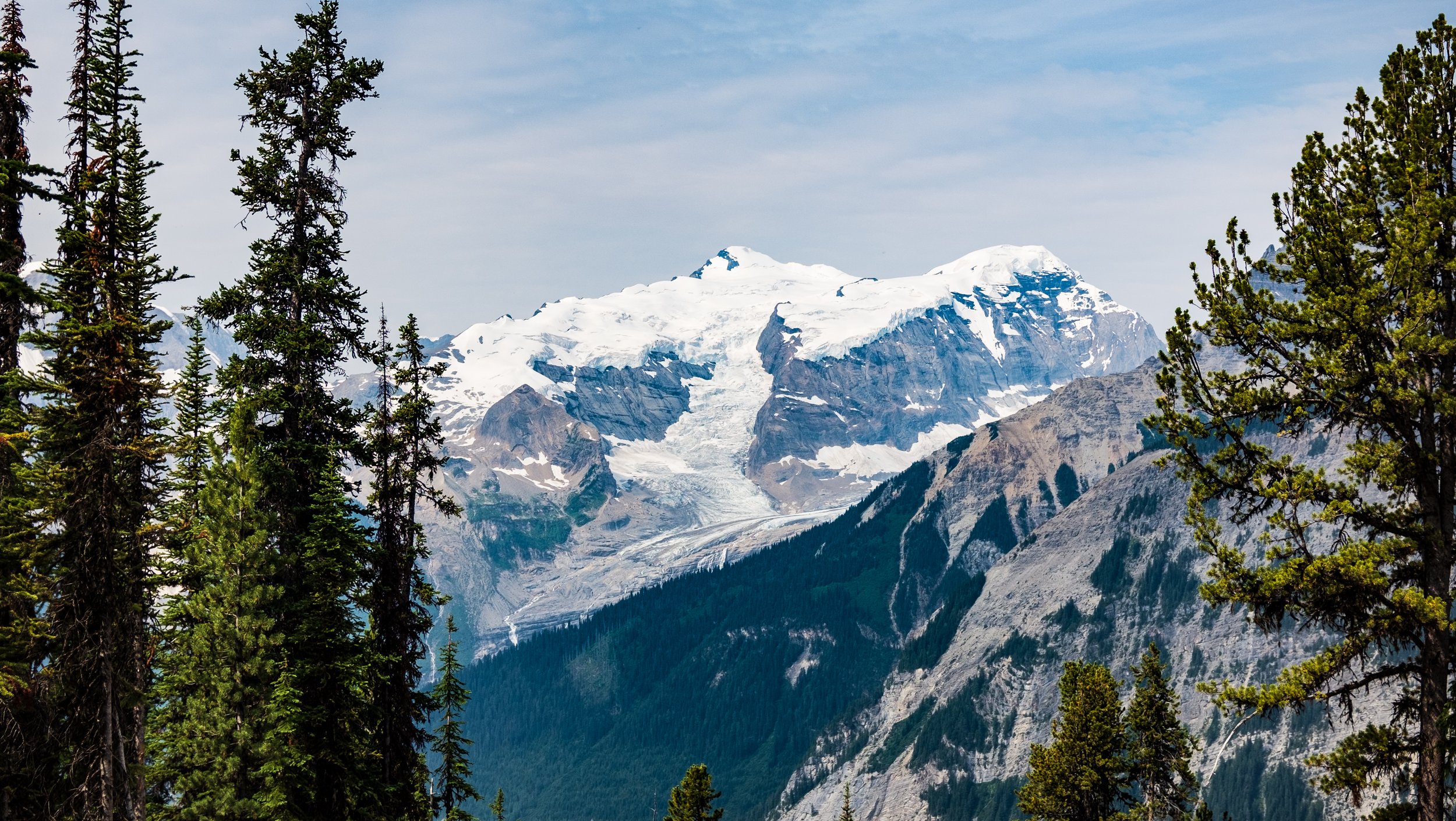
Lovely glaciers.
The logging road is up and down slightly over about 4 km and then is starts to drop down to Blaeberry River. This is an active logging road, so we were very alert and moved off to the side several times when logging trucks drove by.
We took a lunch stop at the bridge over Blaeberry River in the river valley. The trail continues along the logging road. The old road is washed out, but a new road has been built just a bit higher. Take the higher road.

Krysta on the bridge over Blaeberry River.
We hiked 5 more kms down the logging road until we reached the David Thompson trailhead. The camping would have simply been at the end of a logging road here, so we decided to hike along the David Thompson Trail to find a better spot. Only ~150 meters down the trail takes you to Cairnes Creek.

Beautiful camp spot at Cairnes Creek on the GDT.
There are several lovely flat spots along the river. This is a remarkably nice spot considering we were on logging road for almost the entire day. A beautiful freshly built bridge is across the creek.

The incredible new bridge built across the creek.
Day 28: 23 km
Cairnes Creek to Howse Floodplain
The first 5 km on the David Thompson Heritage Trail were absolutely lovely. The trail was well-marked and well-brushed. At about 5 km we began the 300 m ascent to Howse Pass. The pass was lovely with a nice water source which could be a nice spot to camp.

We were so excited as we started to enter the Howse floodplain.
We dropped down 150 m to Howse River and were completely blown away by the beauty! The glacial river has several channels all converging at the base of mountain ranges on all sides. The floodplain had dried in many areas which made for phenomenal walking. Naturally, we opted to stop for a photo shoot.


We walked on the floodplain for ~4 km. At that point the trail dips into the trees above a cliff band. The trail is relatively straightforward at first. Then it side hills along the loose cliff which was a bit scary. Then we lost the trail altogether and tried to bushwhack to the inland trail alternate. This was terrible bushwhacking with lots of deadfall. We retraced our steps and dropped back down to the flood plain. This required a river ford, which was only mid-shin depth.

The incredible Howse Floodplain from the inland section of the trail.
Back on the plain we found our groove again for another 2 km. The trail dips inland once more to avoid cliffs. It’s only 600 m of trail this time and easy to follow throughout. We dropped down on the other side and back onto the floodplain. We found a nice flat spot to call home for the evening. We could tell a storm was brewing so got everything in the tent, had dinner, brushed our teeth, hung the food and got in the tent. We were inside for no more than 10 mins when the rain started and then the thunder and lightning followed.

Our tent set-up on the Howse Floodplain.

Brian purifying our water. There is lots of microscopic debris from the glacial runoff.
Day 29: 20 km
Howse Floodplain to The Crossing Resort
The storm last night dropped a lot of rain. When our alarm went off at 6 a.m., the rain was still falling. When Brian went to retrieve our food bags, he noticed the water level in the channel had risen approximately 2 feet. He was so thankful we chose a high enough camp spot to not be submerged in water.

The absolutely stunning Howse Floodplain.
We knew there were be plenty of river fords today. Reluctantly we got going just as the rain started to subside a bit. We walked along the floodplain for the first 2 km and then forded a thigh-deep side stream to get inland for 2.4 km. This was a mostly well stomped down trail with minimal blow down. The trail rejoined the floodplain for 5 km. We had to ford the side channels of the Howse River, now substantially deeper than yesterday due to last nights rain, approximately 20 times. The deepest was up to Krysta’s belly button (she’s 5’8”).
There were definite moments of fear when crossing the fast-moving glacial streams. The water would chill us to the bone, causing our legs to lose dexterity as we crossed. Our feet felt frozen for the first hundred steps after a ford and sometimes the fords were even closer together than a hundred steps.
Eventually the trail turns slightly inland to the East and climbs a little. This finally brought us away from the marshy floodplain and towards the Mistaya River. We walked this 4 km of trail quickly to keep warm and it was finally an easy to maneuver trail!
The Mistaya Canyon was beautiful and busy – we finally saw other people! We walked the final 6 km of the GDT route to finish off Section D, which is Highway 93! Our legs sped up with the promise of french fries.
We made it to The Crossing Resort at 3:30 p.m. We had veggie burgers and fries, did our laundry by hand, dried our gear and rested.
The Crossing does not have many vegan options. If you are a vegan hiker, we would strongly suggest packing enough food in your resupply box to also feed yourself when resting at the resort.
Equipment Used:
Tent: MSR Hubba Hubba
Backpack: Arc’teryx Bora AR 61 Backpack
Women’sHiking Shoes: Salomon Women’s Outbound Hiking Shoes
Sleeping Pad: Therm-a-Rest NeoAir XTherm MAX Ultralight
Sleeping Bag: Mountain Hardwear Lamina Synthetic Sleeping Bag -18C
Pillow: Sea to Summit Aeros Pillow
Garmin inReach
Gortex Jacket: Montane Women’s Alpine Pro Jacket
Down Jacket: Montane Women’s Phoenix Jacket
Smartwool Longsleeve
Smartwool Shortsleeve
Smartwool Underwear
Fuel
Laundry Soap