GREAT DIVIDE TRAIL - Section C
Krysta continues solo on the GDT. This section is arguably the most beautiful and most popular section of the entire trail.
She hikes 211 km over 9 days.
Distance: 211 km
Days: 9 days
Dates: August 4-12, 2020
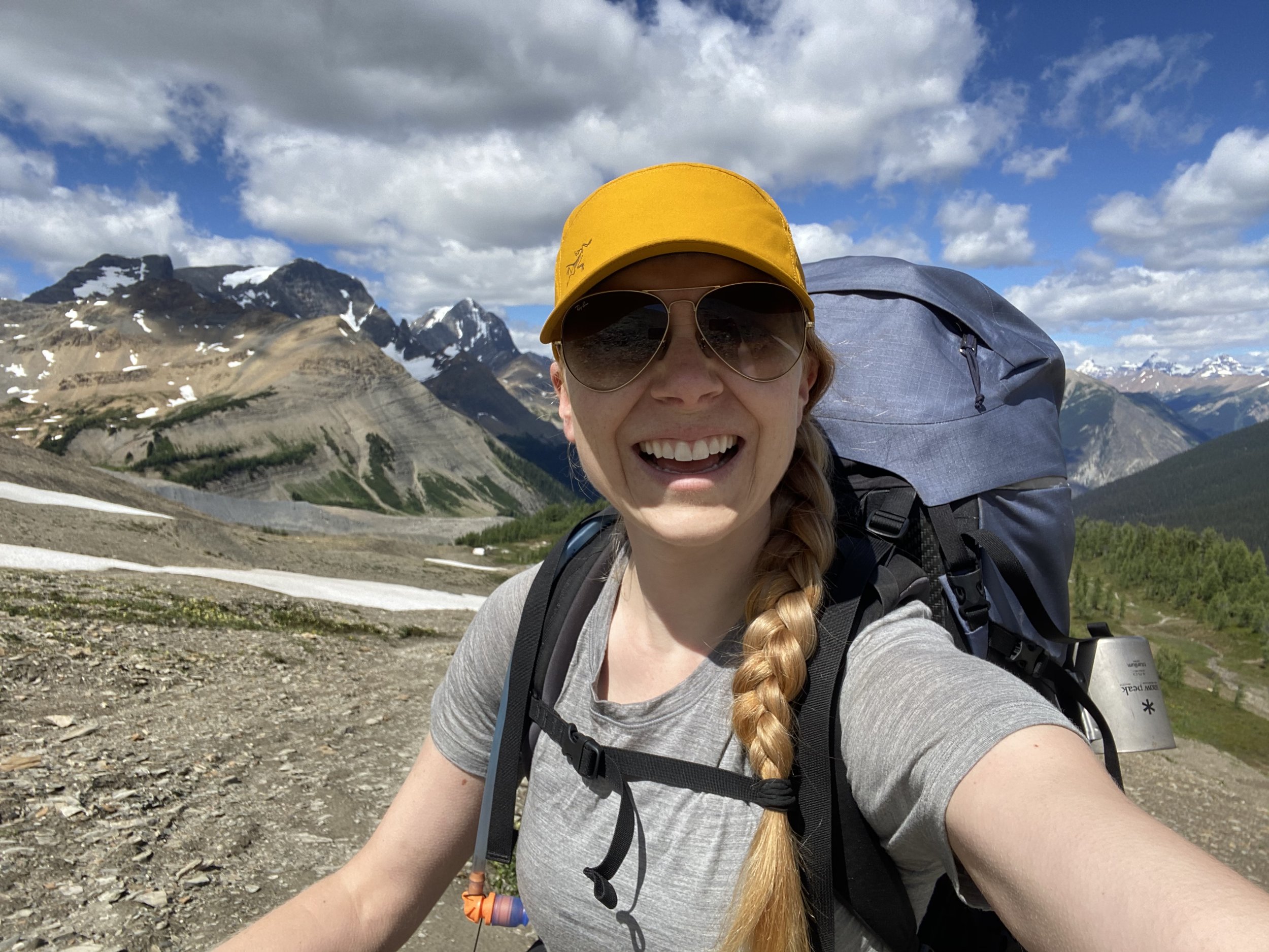
Hiker(s): Krysta Norwick

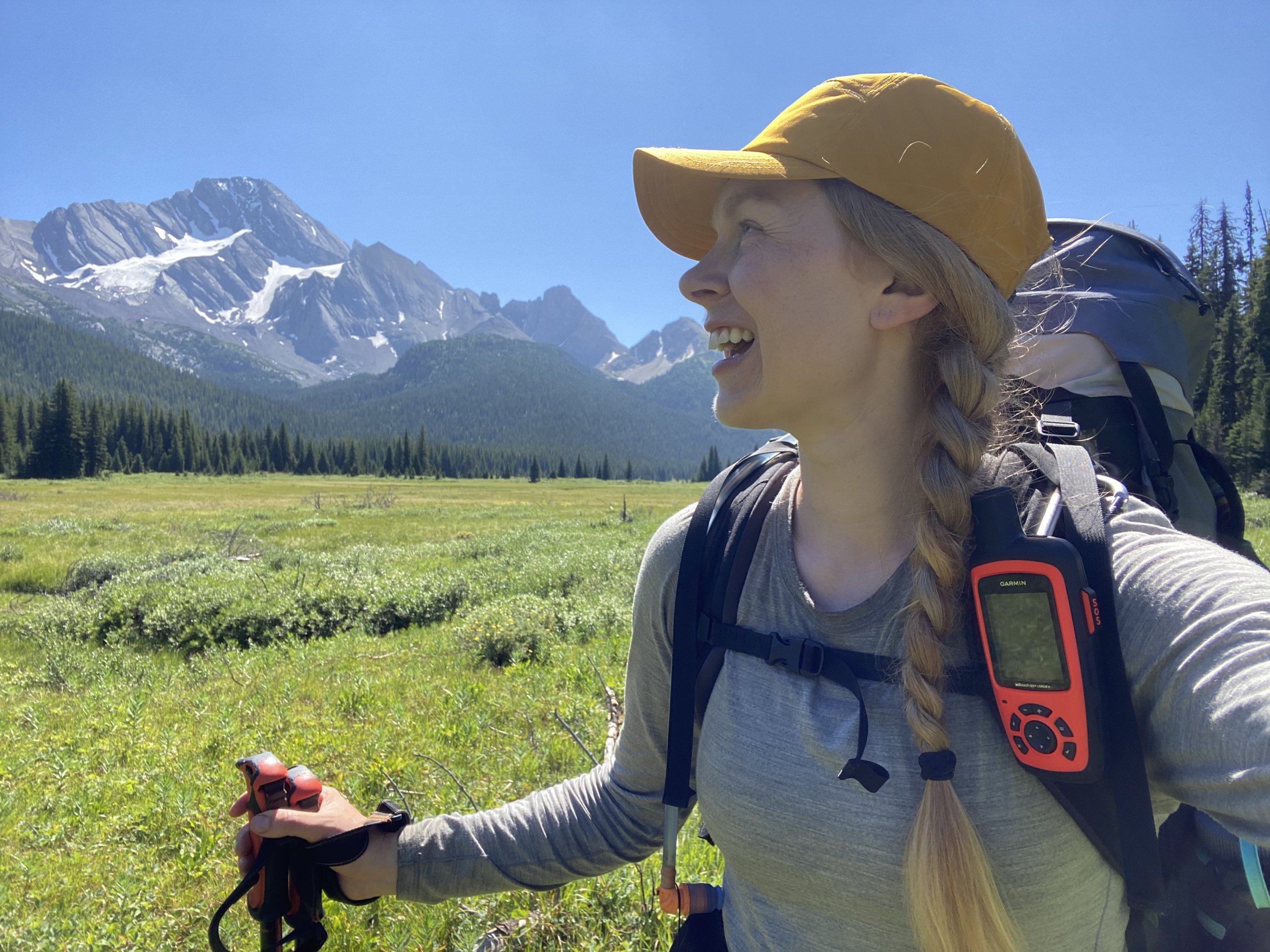
My resupply for Section C on the Great Divide Trail.
Day 15: 30 km
Kananaskis to Palliser River Camp
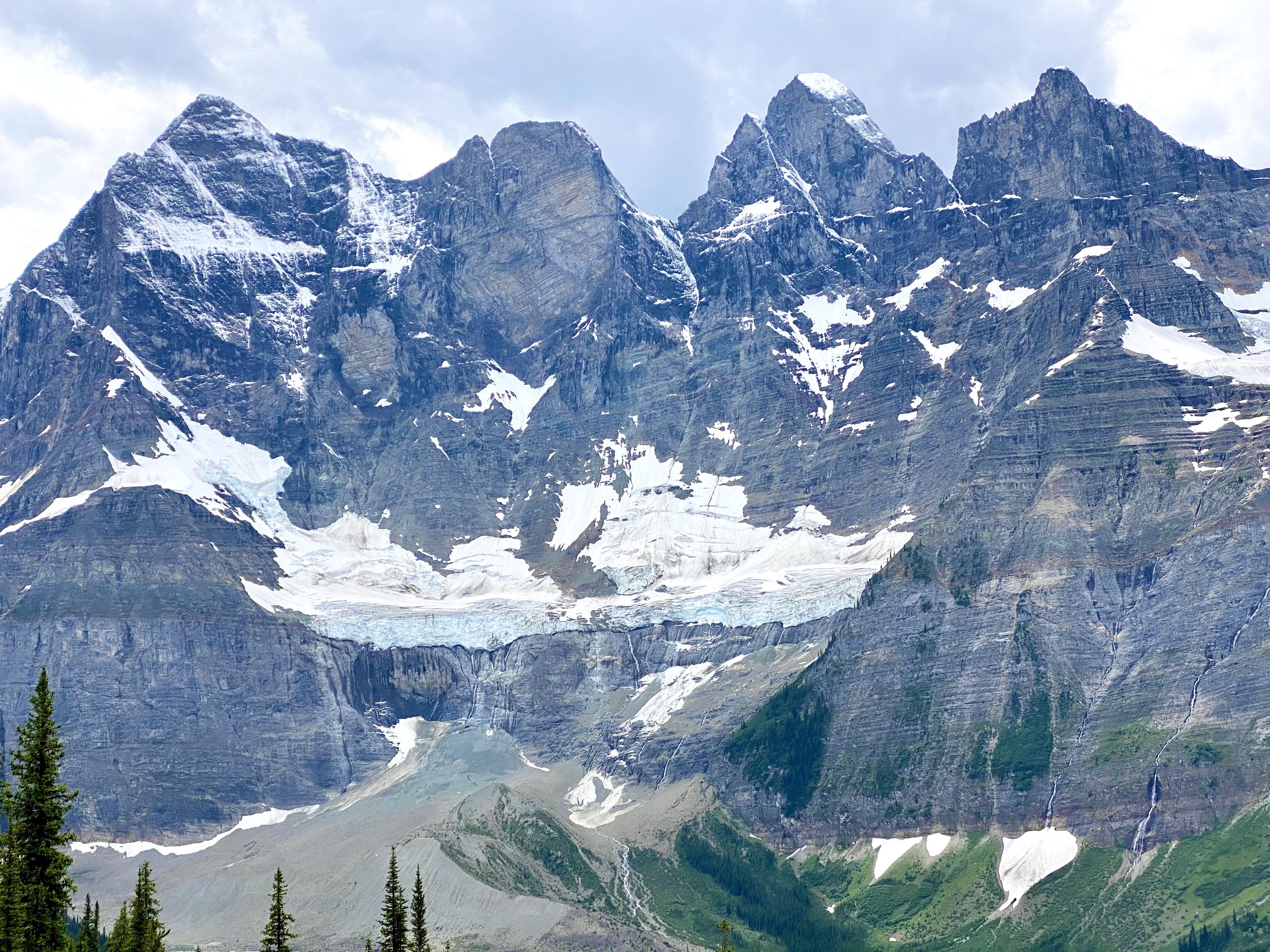
I thoroughly enjoyed the luxury of brewed coffee and showers this morning. Knowing I had a big day, we were in the car by 7:15 a.m. and back on trail at 8:15 a.m. The first 10 km were around upper Kananaskis Lake. It was mostly flat and this was quick hiking. At the north end of the lake you follow signs for Forks Campground. The trail becomes more narrow here, but still very cruisey. After Forks Campground, the trail begins to climb up nice switchbacks. I climbed 300 vertical meters and then punches out into the most stunning alpine meadows. The flowers were blooming, the lake was electric blue and the cathedral of mountains had little patches of snow on them.

The view once gaining into the alpine meadow.
This hiking becomes easy again all the way to Turbine Canyon Campground. There is an excellent water source here and a good spot for a break. The trail then climbs another couple hundred vertical meters to the North Kananaskis Pass. This climbing is straightforward, and the trail is obvious.
The pass is spectacular.
The trail drops down the other side and becomes much more difficult travel. The path has lots of loose scree. I slipped several times. Plan to take your time down this. Once you drop a couple hundred vertical meters the path turns into dirt and snakes downward through trees. It’s mostly easy to follow.
Once in the river valley you have to ford (wade through) LeRoy Creek. There were several fallen trees across the creek and they were sturdy enough that I was able to walk across. They were submerged slightly under water, so my feet did get wet. I continued to lose elevation over the next 1.5 km. I then had to ford Palliser River, which had fallen trees across it. This is not an established campsite. There were only a couple flat spots that would fit a tent. I camped ~20 meters just left of the GDT.

Relaxing at Palliser River Camp.
Day 16: 33 km
Palliser River to Marvel Lake
Last night was cold. I switched my sleeping bag at my resupply in Kananaskis yesterday. For section A and B I carried my -18C bag by Mountain Hardwear. It was bulky and overkill for the first two sections, so I decided to carry a lighter one for the rest of the GDT. I switched to a -9C synthetic down bag by Mountain Hardwear. It wasn’t quite warm enough. I wore my wool long johns, toque, gloves and puffy jacket. I was wishing I had a couple more degrees of warmth in the bag. I was able to dip in and out of sleep for the next few hours.
The first 5 km of hiking today was brutal. The trail was overgrown up to shoulder height at times and covered in dew. I also had to ford a river and submerge my legs to the knees. The trail then steadily climbs to Palliser Pass. Not a good trail. Not a good climb. It was tough to stay motivated.

Beautiful Palliser Lake.
The day got better after passing Palliser Lake and gaining the ridge to Palliser Pass. The next ~20 km are through wide open alpine meadows with peaks on either side. I was able to start moving more quickly through the meadow, but it still wasn’t straightforward wayfinding.
The amazing alpine meadow after gaining Palliser Pass.
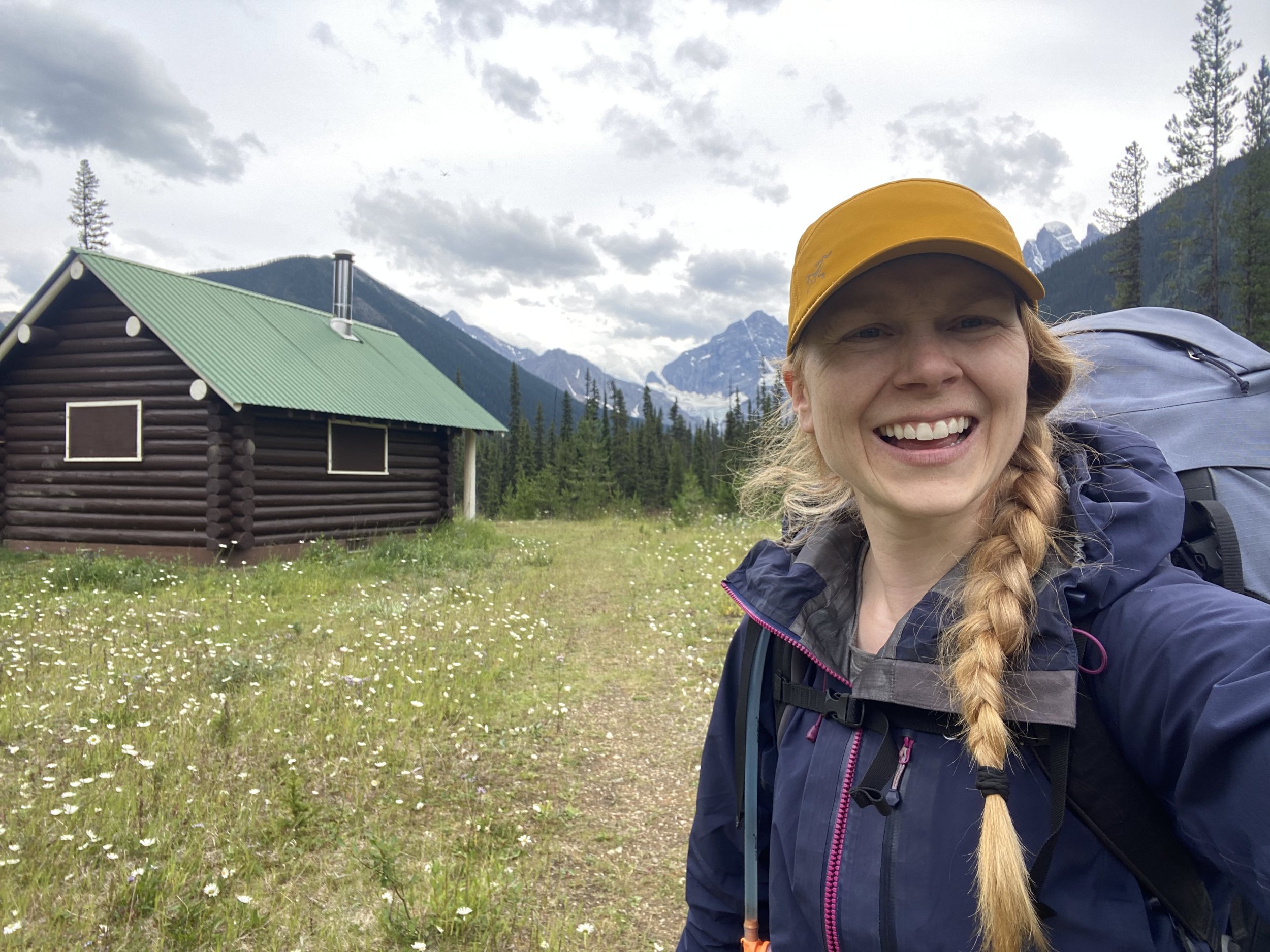
The trail then drops through the trees along Spray River until it comes to a junction with the Assiniboine Pass Trail. The next 6 km is smooth sailing with <100 vertical meters of climbing. It’s a double wide trail and well graded. I hustled this section to make it to camp by 5:30 p.m.
This is a permitted campsite with clear camp spots and a designated cooking area. This feels like a luxury compared to the camp “sites” I am used to.
Day 17: 33 km
Marvel Lake to Howard Douglas Lake
I had a much warmer night last night with my puffy jacket wrapped around my pelvis! I even slept right through my alarm. I finally woke up at 7 am and made my way to the cooking area. I really appreciate the cooking area and food caches being so far from camp.
I hit the trail by 9 am. It is easy from the first kilometer to Marvel Lake. Once I reached the lake, I climbed a bit to gain on the North side of the lake. I then hiked along contour line for several kms before the trail started to slowly climb again. Near the end of the lake, the trail starts to seriously climb. From 1950-2300 meters the trail switches back and forth to gain Wonder Pass. Once on Wonder Pass, the hiking gets very cruisey again as you hike through a big open alpine meadow. There were beautiful marmots as the trail undulates up and down for the last few kms to Lake Magog. There are two great streams for water sources along this section of trail.
I stopped at Assiniboine Lodge (but not in the lodge due to COVID-19 restrictions) for lunch and to take in the views of Mount Assiniboine. It is a stunning mountain and I mentally added it to my to-summit list.
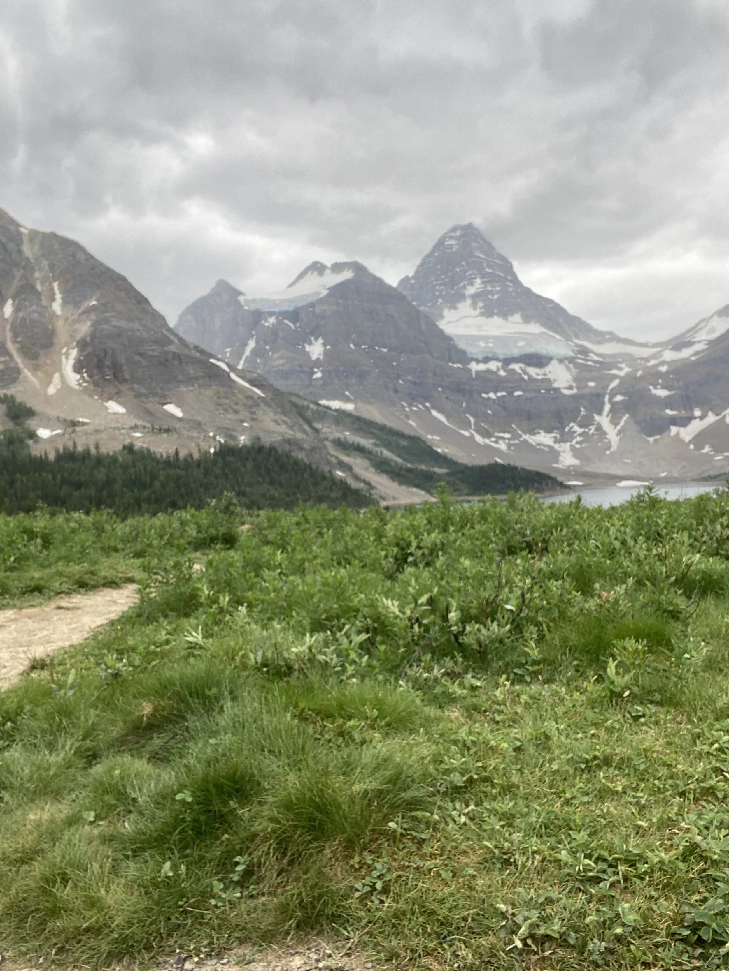
My cloudy view of Mount Assiniboine.
The trail from here to Og Lake was mostly flat and quick moving. Then from Og Lake towards Porcupine Campground the trail becomes more snake-like around boulders. It was pouring rain by this time and I was thankful for my pack cover!
The trail forks before reaching Porcupine Campground. To stay on the GDT, I stayed right to stay high. The trail winds up slowly and then side hills across the slope above Porcupine Campground. You’ve completed probably about a third of the climbing to Citadel Pass by the time you reach the fork in the trail again where you would drop low to Porcupine Campground. Stay right and gain another 300 vertical meters. The trail is easy to follow. Once through this pass the hiking is straightforward. A little up and down and then a final little drop to Howard Douglas Lake.
The last three kms were tough going! I was coming unglued. My body was really starting to bark at me. My legs and feet were sore. My collarbones even more so. I set camp up quickly to get everything out of the rain. I ate my dinner quickly and hit bed before sunset, my usual schedule at this point.
Day 18: 30 km
Howard Douglas Lake to Shadow Lake (Shadow Lake Alternate Route)
It absolutely poured rain all night!! It woke me up it was so loud! I was sleepy getting going this morning.
The hike started with a very short climb up from the lake and then a slow, gentle descent down to Sunshine Village for about 5 km. I was able to get 1 bar of cell service here.

The masterpiece of the trail from Sunshine Village.
The GDT then turns left to stay on the trails and out of the ski village. Follow signs for Monarch Viewpoint. The trail then drops down into an alpine meadow for several kms. The views really open up as you make your way down towards Egypt Lake. This was a magical spot. I was feeling good.

Beautiful wildflowers on the Great Divide Trail.
Stunning view on the Great Divide Trail.
The drop down to Egypt Lake is straightforward. Once there, I made a right after crossing Pharaoh Creek to start the Shadow Lake Alternate route and leave the regular GDT route. The alternate was well maintained until Pharaoh Creek campground and then the trail became more like single track. It was still easy to follow. It seems like this trail has been rerouted so you will not be following exactly what is in the Gaia app. I started to stress, but didn’t need to as the trail does go to the right place! There is a bit of up and down until the trail drops to cross Pharaoh Creek once more (now more of a rushing river). The bridges are all in great shape.

Made it to Shadow Lake Campground.
I continued to follow signs for Shadow Lake and climbed a final ~100 meters over 2 km to get to the campsite. This is a well maintained campsite adjacent to Shadow Lake Lodge.
Day 19: 27 km
Shadow Lake to Floe Lake
Fatigue is really starting to set in. I had a slow morning making coffee and eating a good breakfast of wraps with peanut butter.

Hiking just past Shadow Lake awarded me with epic views.
The trail started off easy with lots of views to take in. After 5 km I started to climb slightly. At 7 km the alternate route joined the regular GDT route and began to climb to Ball Pass. This is a 400 vertical meter climb with some loose rock for the last 150 meters.
After Ball Pass, the trail begins it’s slow drop all the way down into the valley to highway 93. I passed through some old burnt forest with new growth sprouting up.
There is a trail along the east side of highway 93, I followed this and then crossed the highway to Floe Lake parking lot. I stopped here for a bathroom break, to eat a snack and to ditch my tiny bag of garbage.
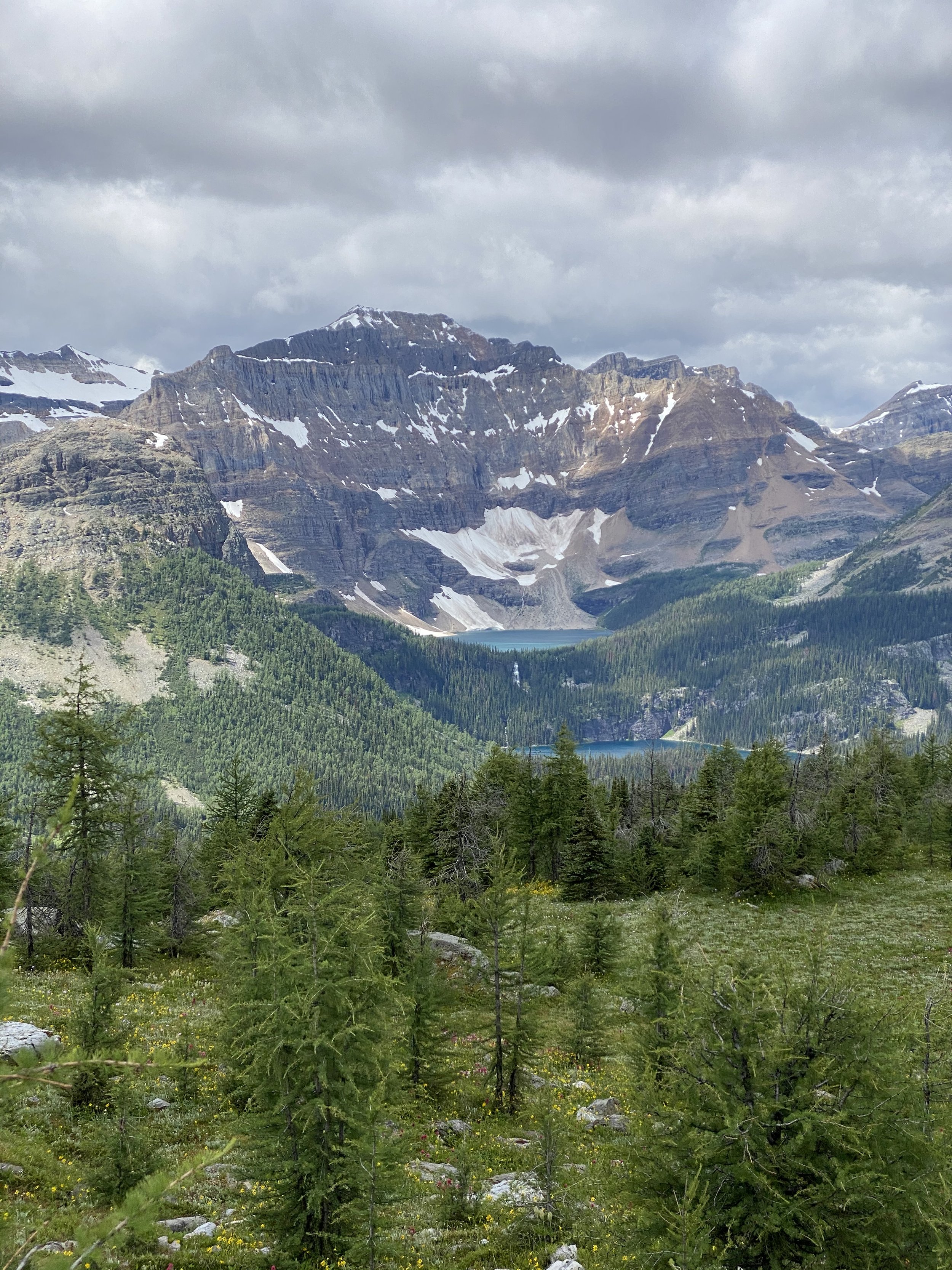
The Floe Lake Trail is well used and well maintained. It climbs slowly up the river valley at first. The views of the avalanche slopes and wildflowers are a sight to take in. For the last 1-2 km the trail switchbacks aggressively to gain the ridge east of Floe Lake. The trail then drops through a lovely meadow to the campground. It’s a wonderful campground with great tent pads and an even nicer cooking area! The turquoise lake nestled in a cathedral of mountains is calming to the mind and soul. I felt at ease with the fact that my 30 km days were over and I was on a popular route.
The incredible Floe Lake on the Rockwall Trail.

My tiny home on the Great Divide Trail at Floe Lake.
Day 20: 10 km
Floe Lake to Numa Creek
Fatigued continued to plague me. I was dreading getting on trail this morning. I didn’t have enough energy and my hunger was insatiable.
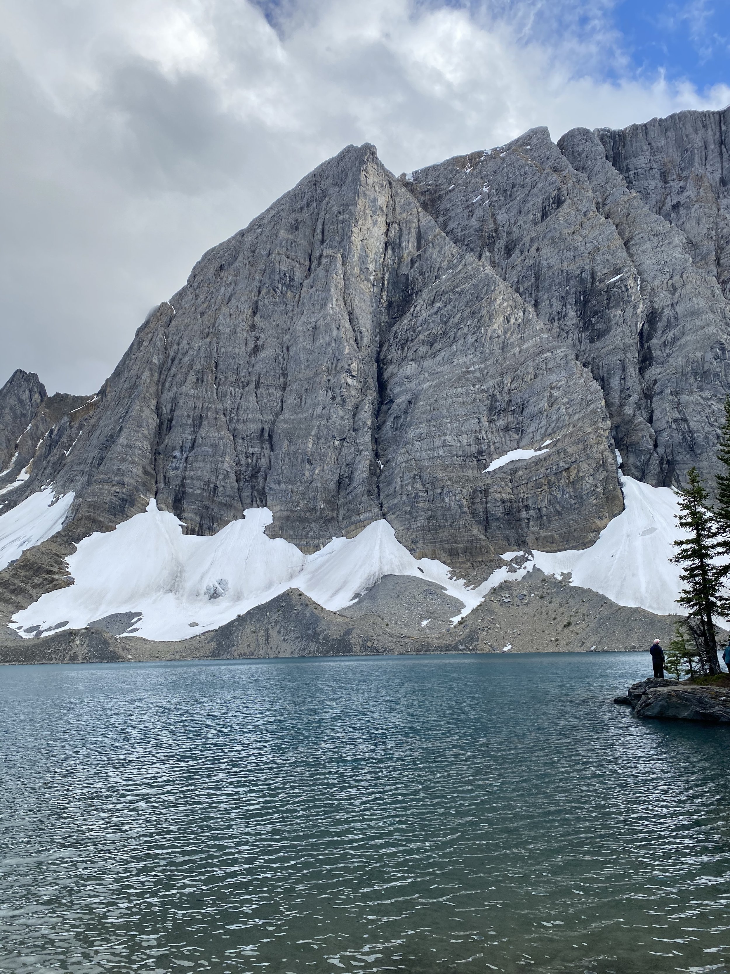
The hike starts with a steady climb about 400 vertical meters up to Numa Pass. It is relatively smooth climbing. Numa Pass is spectacular. It was so incredible that it moved me to tears. It was one of those moments that makes all the difficult moments worth it.
All smiles on Numa Pass.
Dropping down from Numa Pass is equally breathtaking. The trail is easy to follow and switchbacks down into the trees. I then dropped 700 vertical meters over about 8 km.
Numa Creek is a nice and popular camp spot by the river. There are many tent pads and lots of bear caches.
Day 21: 8 km
Numa Creek to Tumbling Creek
The morning starts with a steady climb away from Numa Creek. These were good switchbacks but there was some loose rock and stream crossings as you get higher up. The trail climbs 500 vertical meter to the alpine meadow.

The Rockwall Trail.
The views are incredible.

Tumbling Creek Campsite.
From here, the drop down to Tumbling Creek is straightforward and short, only 300 vertical meters. The campground is larger than it first appears, so be sure to wander around to find both cooking areas, outhouses and clusters of tent pads.

A little self-care at camp.
I was feeling very stressed out today. I think I was having a tough time adapting to the shorter days after having so many long days in a row. I was also struggling with the sudden socialization I was experiencing by being in such a popular trail. I find it interesting how I can crave human interaction when alone, but then crave alone time after some socialization. It really is a delicate balance.
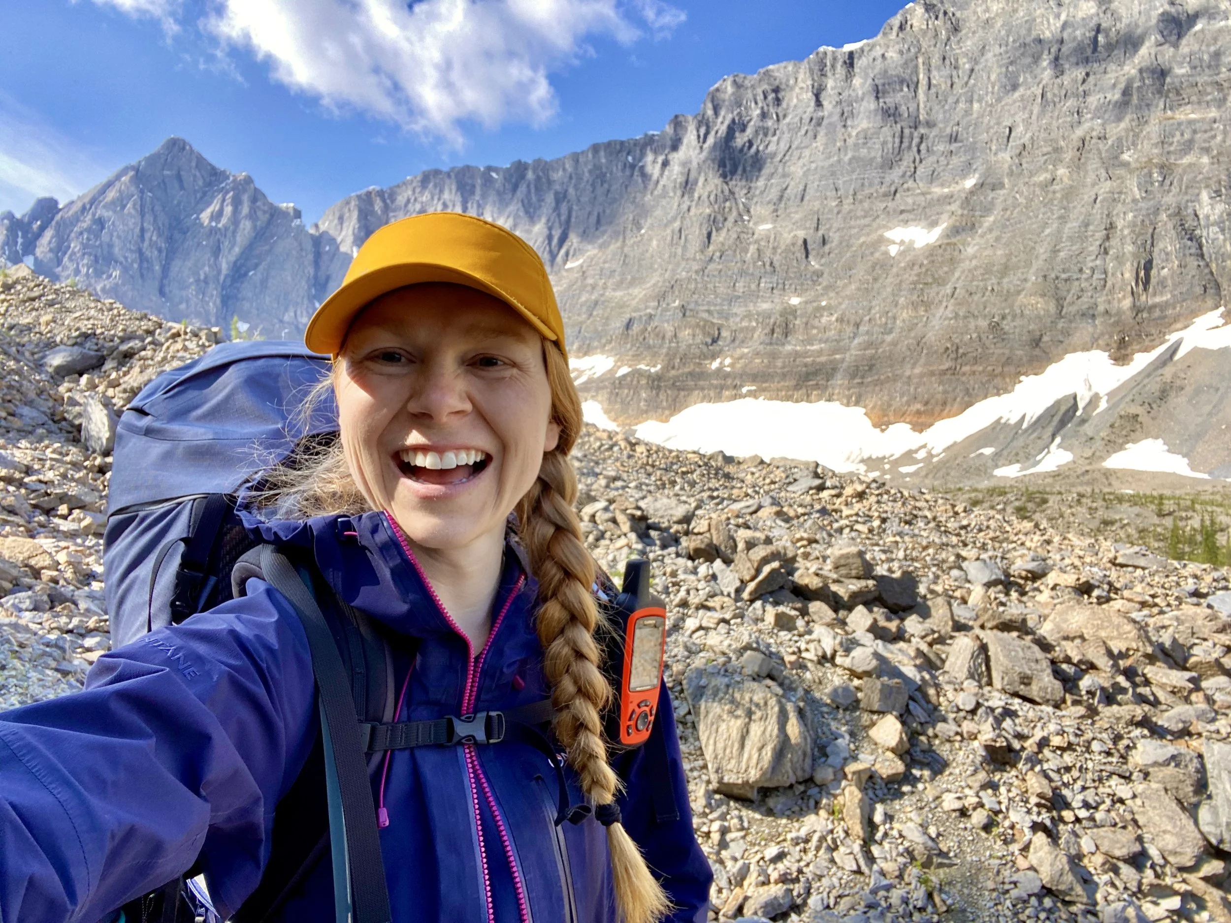
Day 22: 25 km
Tumbling to McArthur Creek
This view motivated me up the first climb from Tumbling Creek.
After the two shorter hiking days my legs were super well rested! I flew up the first climb to Rockwall Pass (300 vertical meters). This alpine meadow was one of the best of the trip thus far. I experienced it alone.

Rockwall Pass.

All smiles in Rockwall Pass.

The Rockwall Trail.
Such a great day of hiking!
After a couple kms in Rockwall Pass the trail drops down towards Helmet Falls Campground. After 350 vertical meters the trail arrives at camp. This looks like a nice place to stay with a ranger cabin at the North end. I kept walking passed the cabin until there was a fork in the trail. Where the Rockwall Trail goes East towards highway 93, I continued North towards Goodsir Pass.
The trail instantly appears less travelled with more brush and less trampling from hiking boots. I had a feeling I would see no one on this trail as soon as I stepped foot on it. And I was right. There were many more trees blown down across the trail which required patience to get over and under. The trail started climbing immediately and I was happy it was switchbacks.
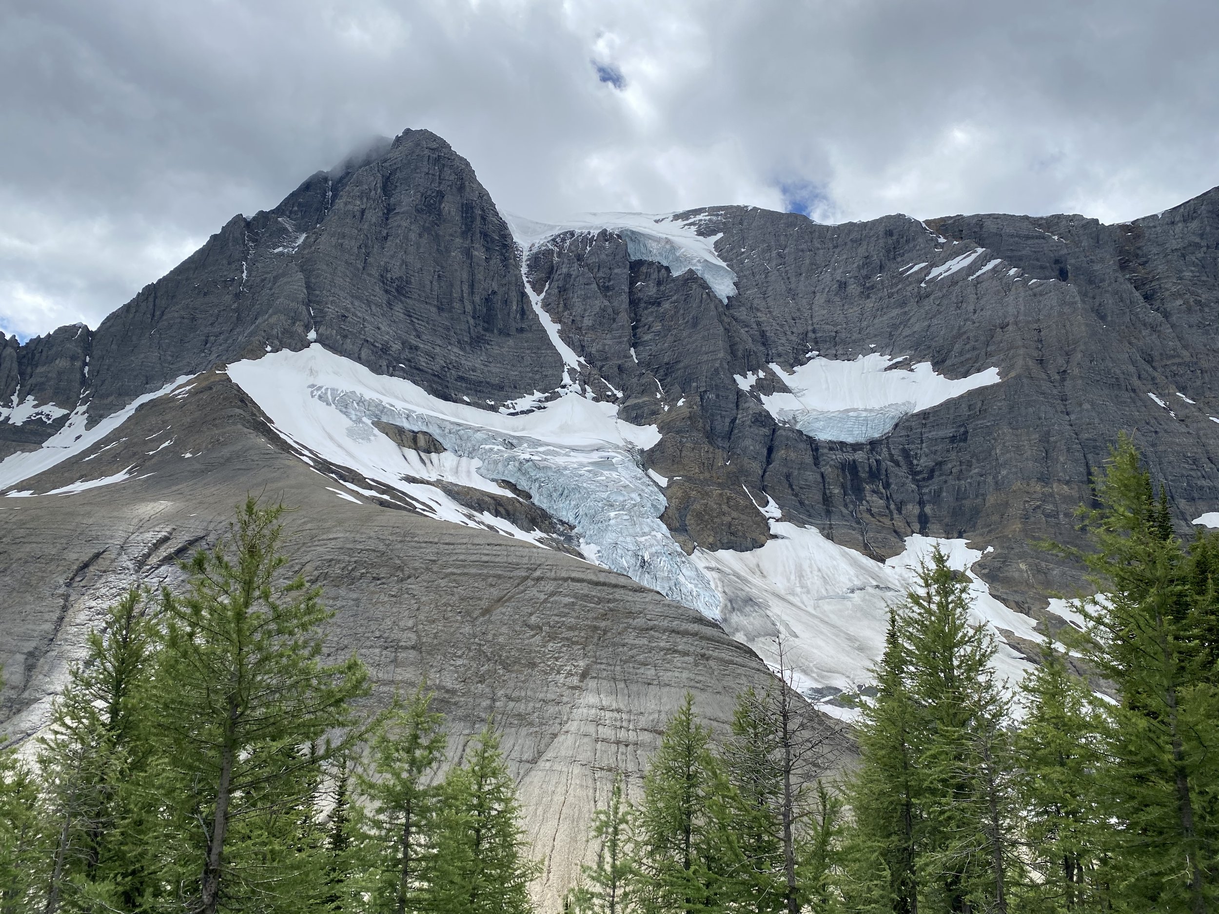
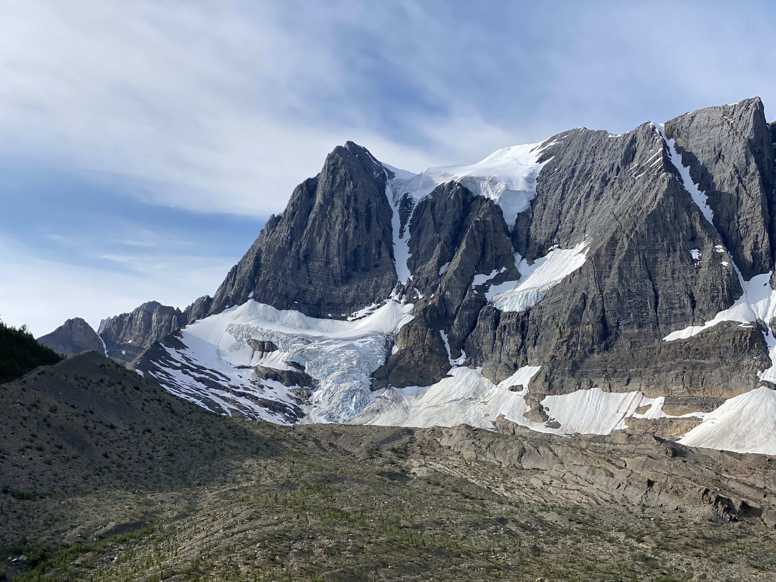
The trail gains 450 vertical meters and then you are rewarded with an amazing view of Sharp Mountain and Mount Goodsir – true sights to behold. You stay high for about 3 km before starting the slow drop down towards McArthur Creek.
Epic views of Sharp Mountain.
The trail drops steadily with lots of blow down and brush. You cross ~4 avalanche paths which allow for some stunning views of Mount Goodsir and the massive Goodsir Glacier. You drop 700 meters overall.
McArthur Creek Ranger Cabin.
Once in the valley, it’s less than 2 km to McArthur Creek Campground over easy terrain. You walk past the Ranger cabin (unoccupied) and onto what seems to be an old road. The camp is on the left and the eating area is to the right.
Day 23: 15 km
McArthur Creek to Field
I was giddy when I woke up. I tried to take my time packing up because I knew Brian wasn’t going to be at the trailhead until 6:30 p.m. But I was too excited. I got moving by 9 am.
The trail is an old logging or fire road. The parks crew had recently done maintenance, so all the blown down trees had been cleared. This made for quick movement of a wide and mostly flat trail. I arrived in the parking lot at 1 pm.
I sat there for an hour, ate the rest of my snacks and called Brian. When he confirmed he was still 5 hours away, I decided to continue on the GDT and follow it into Field. I was fueled by hunger.
Once in Field I went to the Truffle Pig. I was ravenous for everything I like. I ordered an apple juice, oat milk latte, jug of water, and a pint of beer. Oh – and a vegan burger with fries.
It was everything I had been daydreaming of.
When I left the restaurant, I was walking to the coffee shop next door when I heard someone call my name. It was Avocado!! He had hitched a ride with a couple other hikers and they were sitting there eating burgers! What great timing! Brian got there 20 mins later to drive us both to Golden.
We are reunited and feeling good! Time for 5 days of resting and eating.
Equipment Used:
Tent: MSR Hubba Hubba
Backpack: Arc’teryx Bora AR 61 Backpack
Women’sHiking Shoes: Salomon Women’s Outbound Hiking Shoes
Sleeping Pad: Therm-a-Rest NeoAir XTherm MAX Ultralight
Sleeping Bag: Mountain Hardwear Lamina Synthetic Sleeping Bag -18C
Pillow: Sea to Summit Aeros Pillow
Garmin inReach
Gortex Jacket: Montane Women’s Alpine Pro Jacket
Down Jacket: Montane Women’s Phoenix Jacket
Smartwool Longsleeve
Smartwool Shortsleeve
Smartwool Underwear
Fuel
Laundry Soap