Sunshine Coast Trail Thru-Hike
A 178 km trail near Powell River, British Columbia. The elevation of the trail ranges from sea-level to 1,300 meters.
Dates: June 11-19, 2020
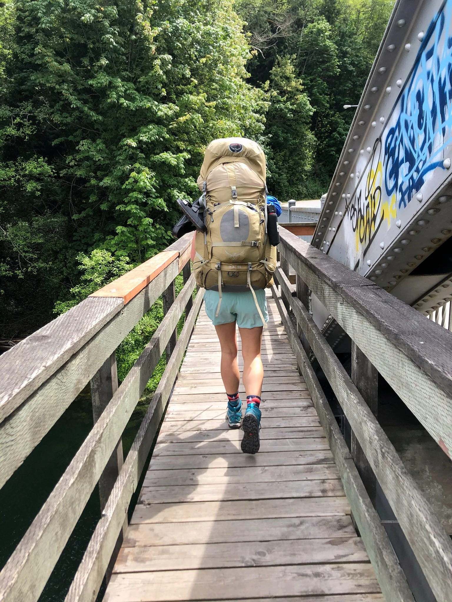
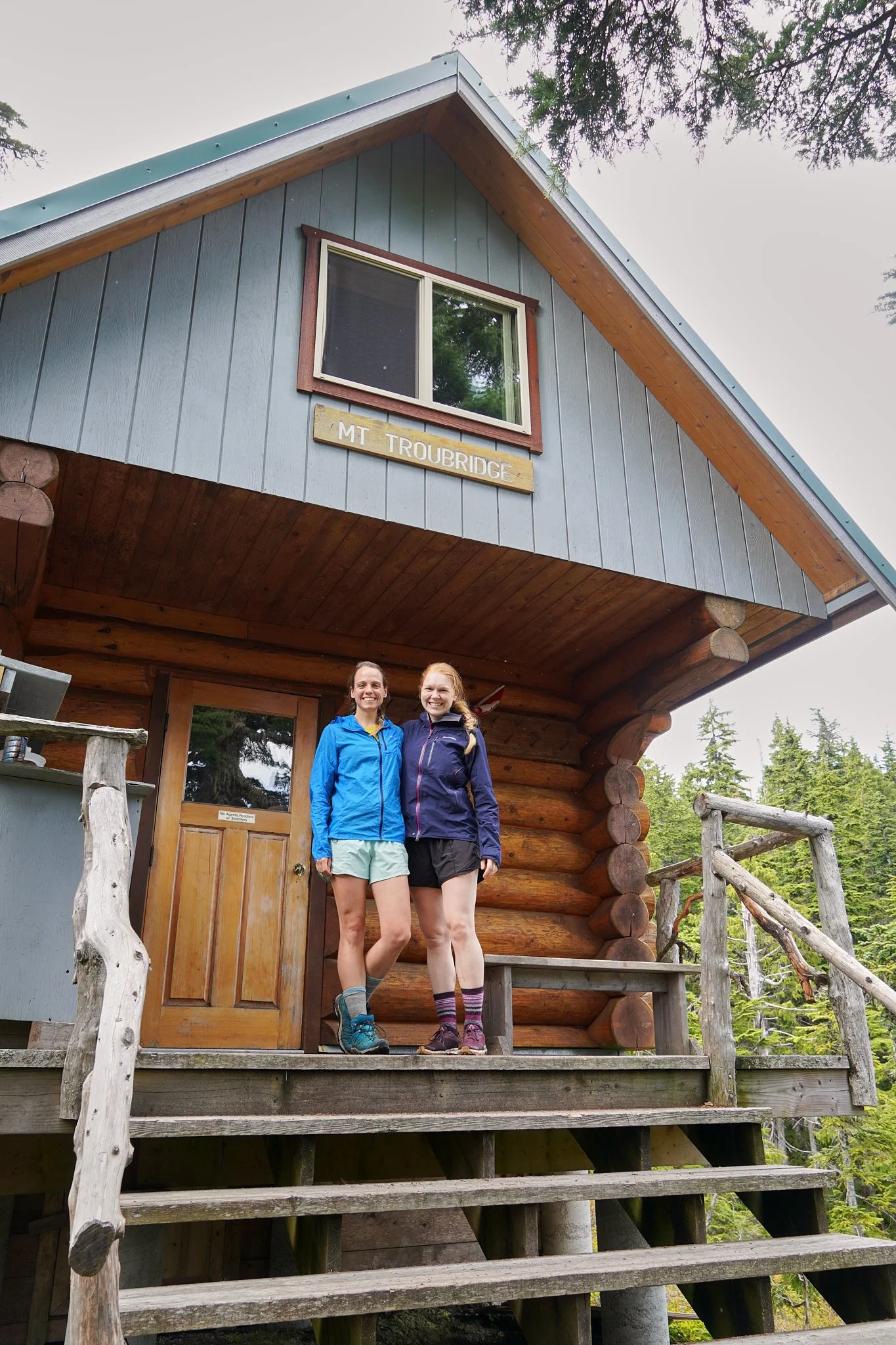
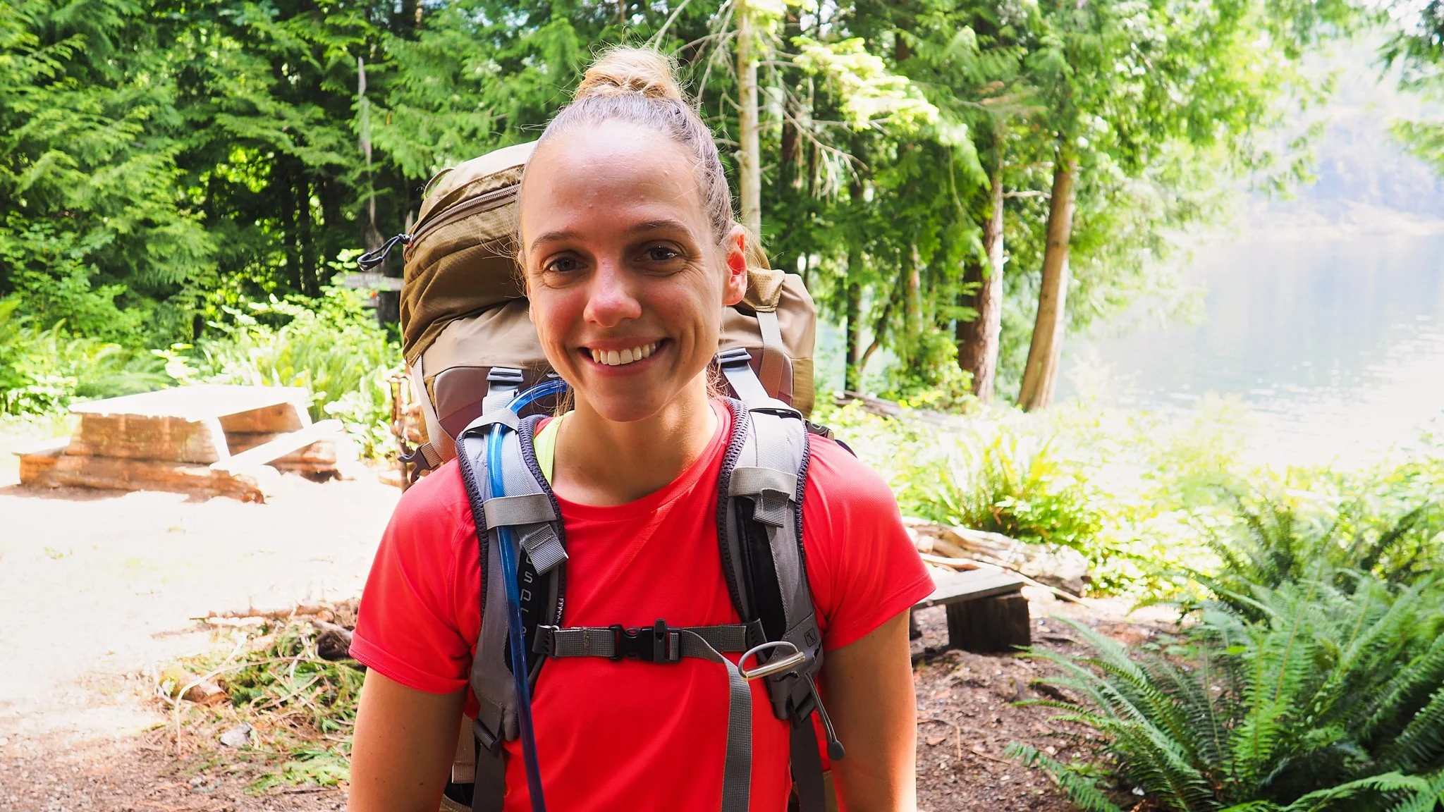
Trip members: Krysta Norwick and Erin Duhaime
Direction: North to South (Sarah Point to Saltary Bay)
Day 1: Sarah Point to Manzanita Bluff 1- 17 km (17 km of hiking over 6 hours)
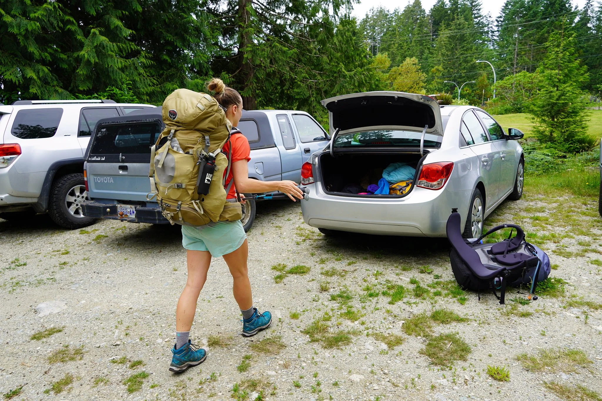
The morning of the first day we dealt with logistics. We dropped our first food drop off at Lang Bay store, where they graciously held our food bin for us for free. We then dropped Erin’s car of at Saltary Bay. We chose the paid parking lot which cost $5 per day. You can pay in either cash or e-transfer.
We then took a taxi ride from Saltary Bay all the way to Lund which cost $150. The taxi driver stopped for us at Shingle Mill Pub to allow us to drop our second food drop off. They also graciously allowed us to store our food bin for free.
We met Erin’s father-in-law in Lund. He drove his boat over from Campbell River to drop us off at the start of the Sunshine Coast Trail (SCT) at Sarah Point. We spotted sea lions along the way and then Pete dropped us off on the rocky beach at the start of the trail. He didn’t want us to get our shoes wet so he piggy-backed me off the boat! What a gem!
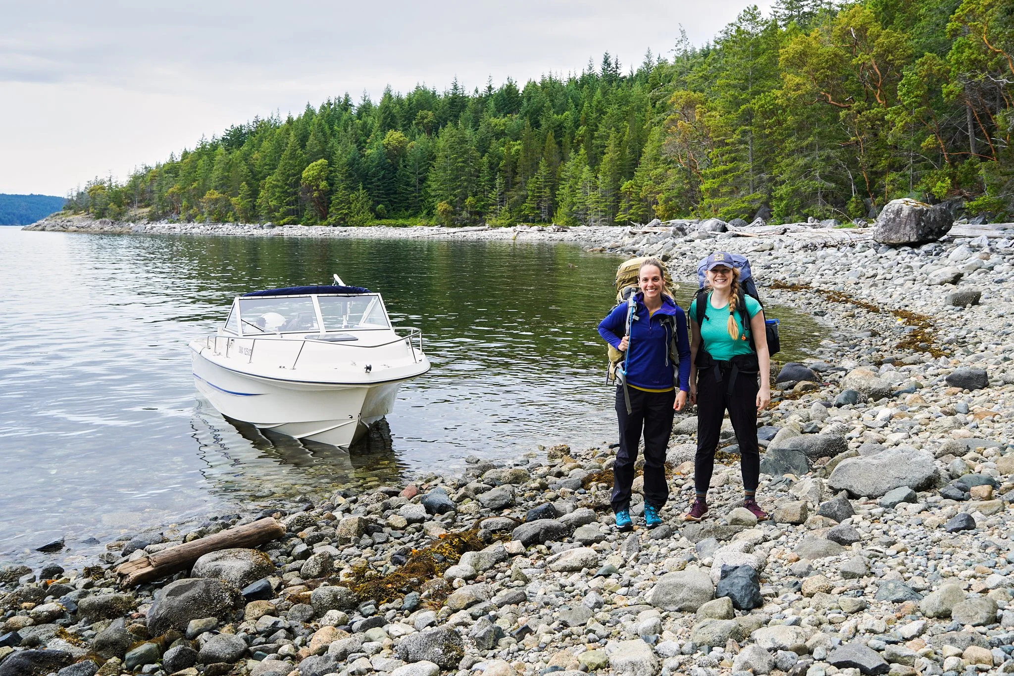
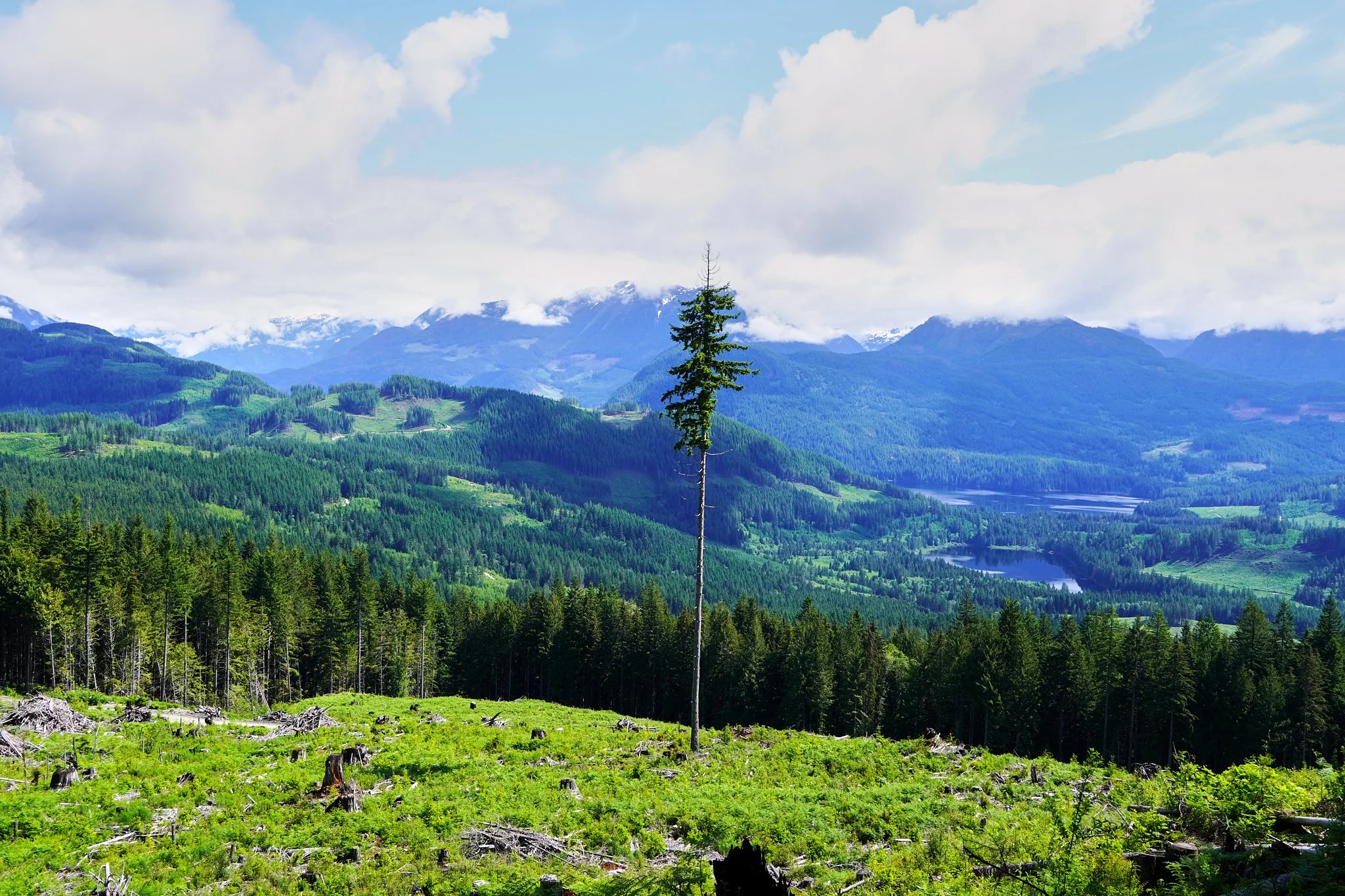
The trail starts off along the ocean and climbs up and down seaside bluffs. After a few kilometers the mossy bluffs climbed up towards more dense trees. The months of dealing with a pandemic and spending more time indoors really caught up with us on this climb. The packs were weighed down with 3 days of food and creaked under the load. My breathing quickened as we climbed gently into thicker forest. The next few kilometers were undulating, and we passed the signs of a new hut build at Bliss Portage.

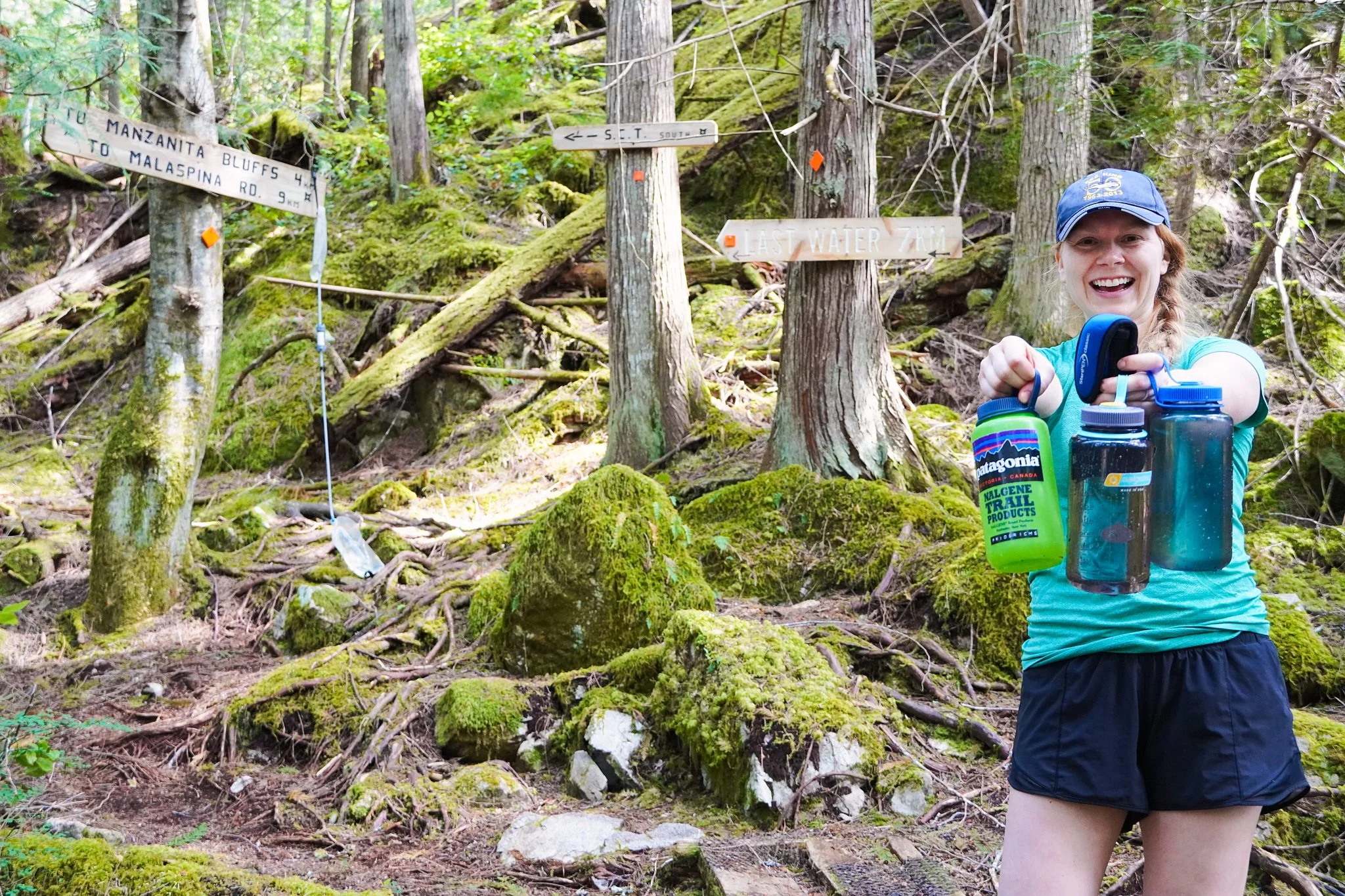
We then took our time slowly climbing up the 300 vertical meters to Manzanita Bluff. We passed the final water source 4 km from the hut. The river is well marked as the final water source.
Due to the pandemic, we carried a tent with us the entire trail to try to stay out of the huts as much as possible. We set up under a tree, enjoyed a delicious vegan burrito dinner and took in a stunning sunset.
Day 2: Manzanita Bluff to Kokanee Creek 17-41 km (24 km of hiking over 9 hours)
The start of the hike immediately drops off the south end of the bluff for 300 vertical meters. I started to notice my right knee bothering me. It felt like my right knee was catching or getting a bit locked up. I tried doing a quick on-trail physiotherapy treatment on myself, but it didn’t seem to do much.
After the initial drop down off the bluff, the vast majority of the day was relatively flat. We crossed several logging roads and mostly hiked through either cut blogs or old growth forest.
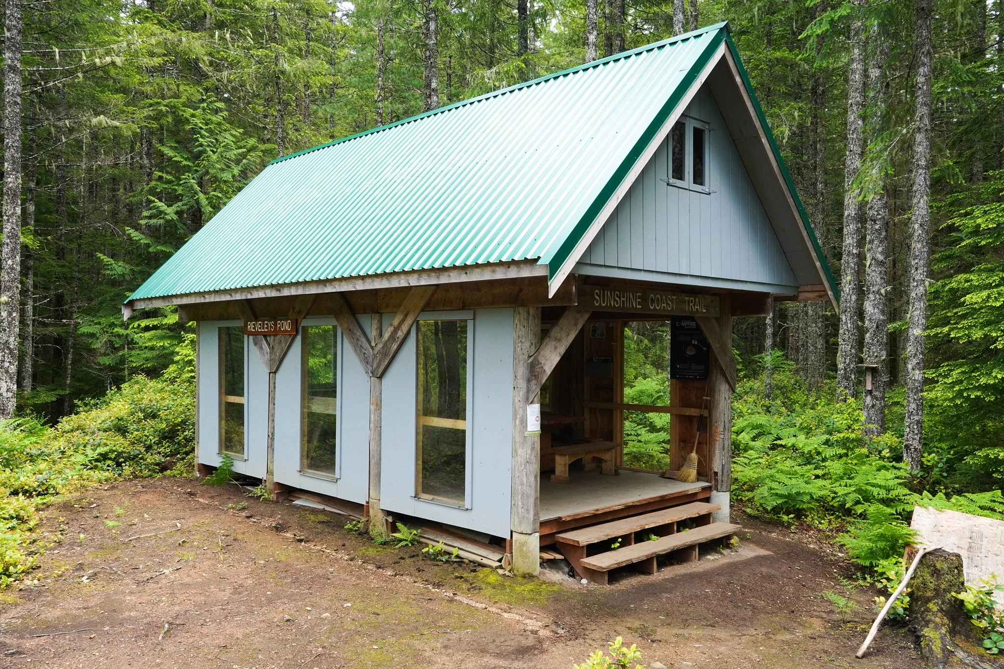
Once we reached Rieveley Hut we were starting to feel the fatigue. The hut was well maintained with a cute view of the pond.
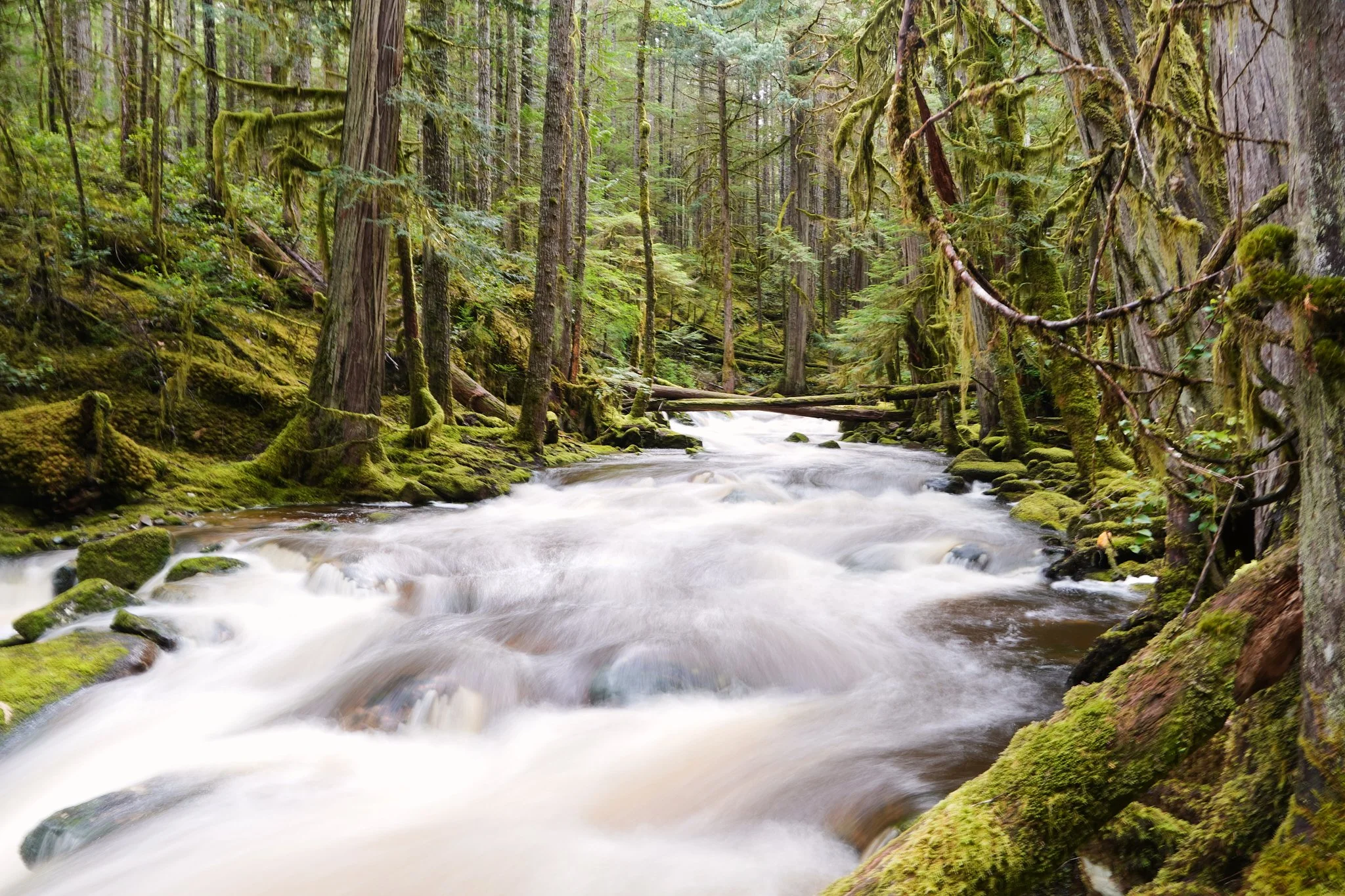
After the hut we completed a short climb and passed a beautiful rushing river. Some gentle up and downs all the way to Kokanee. We dealt with rain on and off.
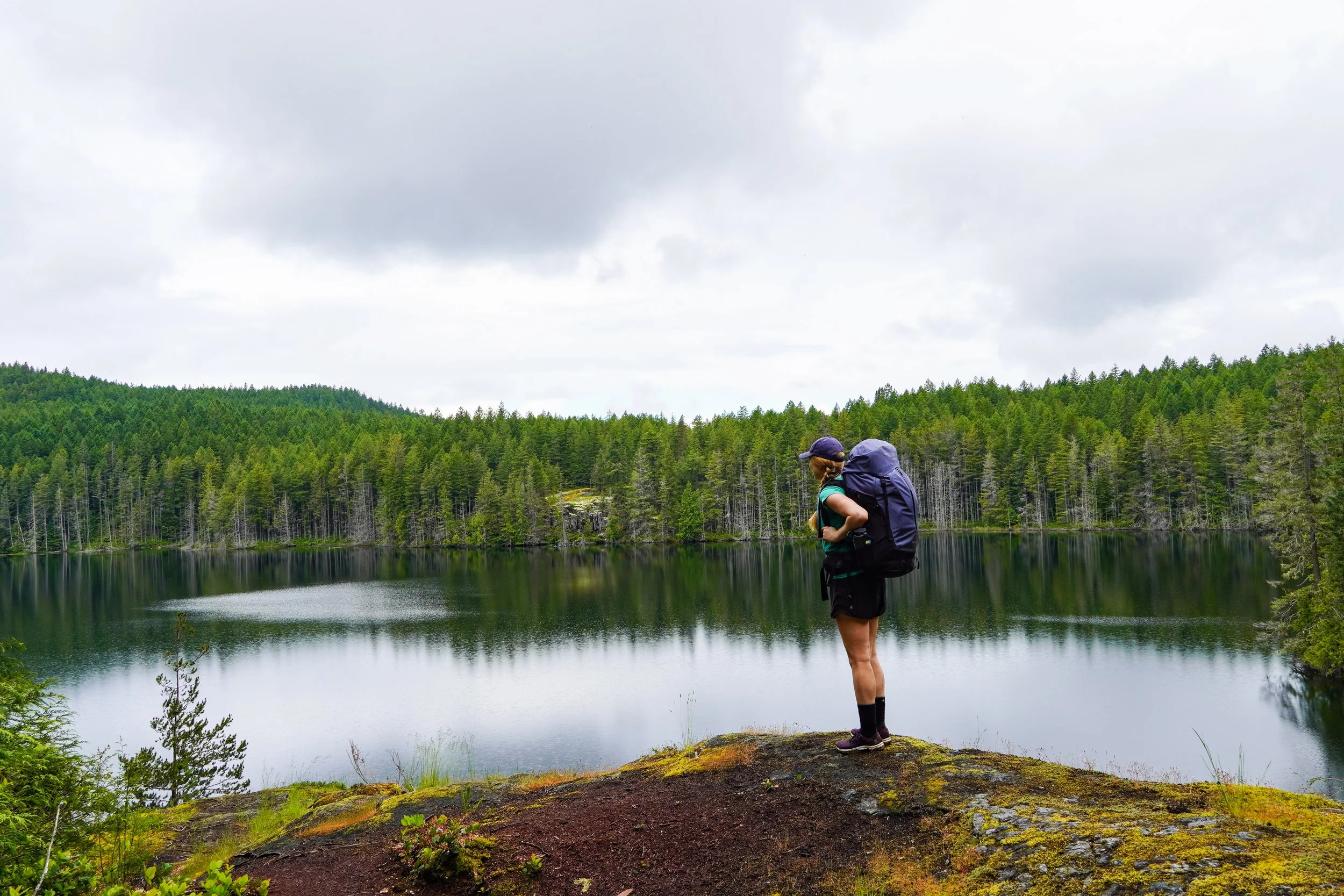
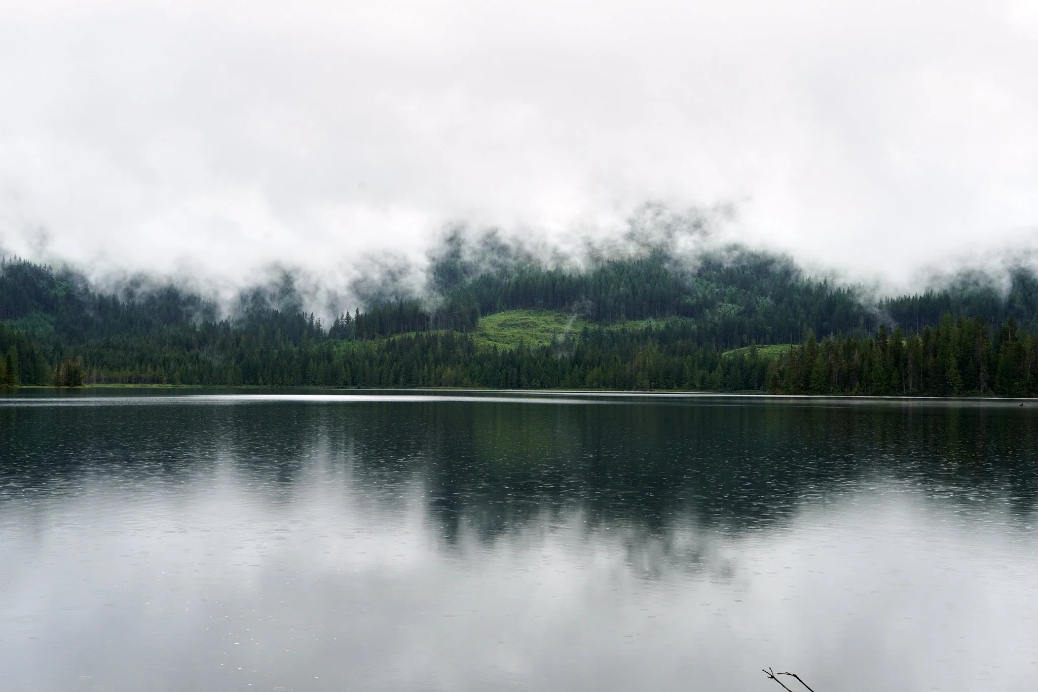
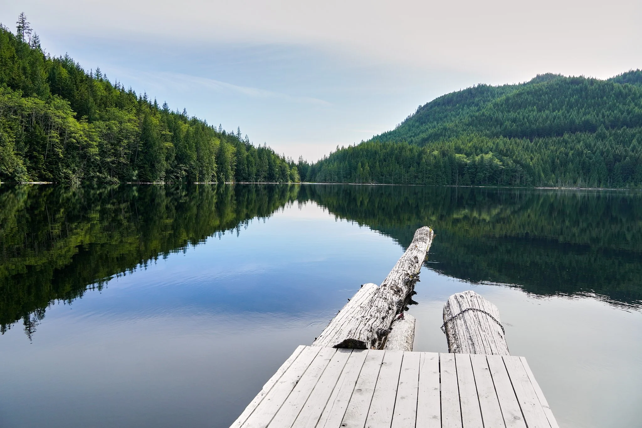
This was a very cute little camp spot with an incredible view of the lake. There was a well maintained outhouse and several flat spots for tents.
Day 3: Kokanee to Haywire Bay 41-58 km (17 km of hiking over 8 hours)
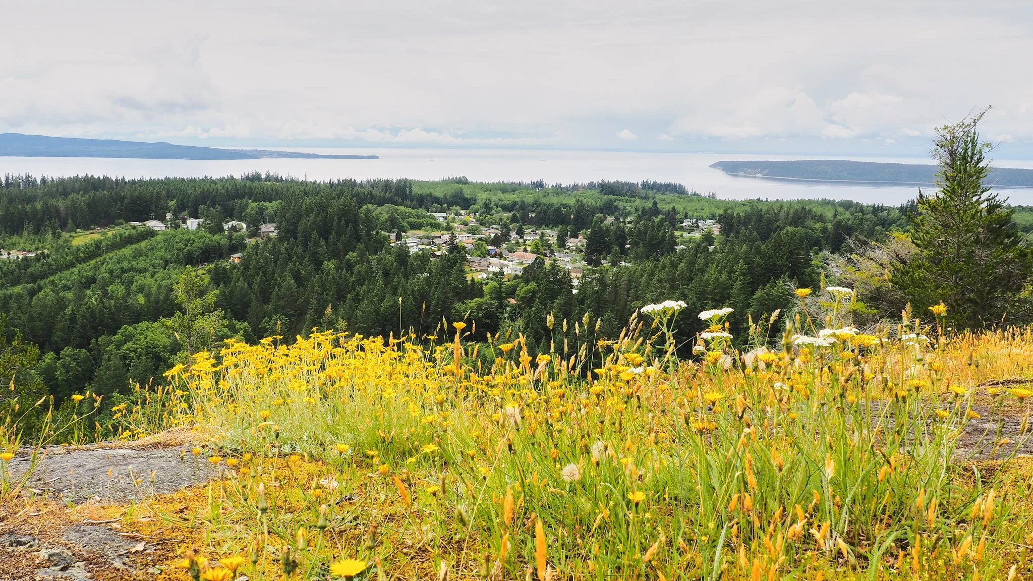
The beginning of the hike followed along the shores of Sliammon and Little Sliammon Lakes. After a few kilometers, we climbed up to the bluff to the East of Powell River.
This was a stunning time of year with all the beautiful flowers blooming on the bluff.
The drop down off the top of the bluff is pretty cruisey (aka chill). A couple technical points, but nothing too challenging. The trail connects with a road which is a couple kilometers from the Shingle Mill Pub at the end of Powell Lake. It’s smooth sailing from here.
We resupplied at Shingle Mill and enjoyed a really delicious lunch with a cider. It was a beautiful break. It was also a great opportunity to leave some of our items we didn’t think we would use on the next leg of our trek.
After lunch we walked across the bridge and rejoined to the trail to the left just off the bridge. The trail followed along the South edge of Powell Lake for a couple kilometers and crossed a few gravel roads. From one of the roads, we started to climb up through a thin section of forest, which was really sunny. This was the most challenging part of the day as we heated up quickly. We dropped down the other side towards Haywire Bay.
The final approach to Haywire Bay is along a road, ensure you don’t turn right off the road too early into the private cabins. You should stay on the road until you get to a boardwalk along the water. This is a beautifully well-maintained stretch of lakeshore.
We finally arrived at the Haywire Bay car camping site. We walked onto an empty site and then paid $25 for the night at the entrance to the campground. There are shower facilities here that you need loonies for, so carry them if interested. We didn’t, so we just had a nice lake swim to clean off 3 days of sweat.
There were water taps, garbage cans, firewood and a nice swimming area. This is a good refresh spot. Note: the SCT continues to the right just after site number 5 (this is where we chose to camp).
Day 4: Haywire Bay to Fiddlehead Landing 58-81 km (23 km of hiking over 8 hours)
This day started off with a gentle climb through the forest. We passed through a cut block. We eventually came upon a small lake and hiked around the shore. It wasn’t long before we reached Inland Lake. We decided to walk around the lake in a counter-clockwise direction, although we could have stayed on the SCT and gone either way. This is a very chill section of trail with a well-manicured path. There was another parking lot with garbage bins. We also saw many garter snakes, but don’t worry, they are generally harmless to humans.
We took a right onto the SCT once around the far side of Inland Lake. This started us on quite a big climb through the forest. It was ~800 vertical meters of climbing! Needless to say, we were sweaty at the top. There was a beautiful waterfall called Stealth Falls about ¾ of the way to the top of the climb.
At the top of the climb we hiked along Confederation Lake to the winterized hut there. The hut was clearly closed due to COVID-19. It looked like a great hut to stay in year-round!
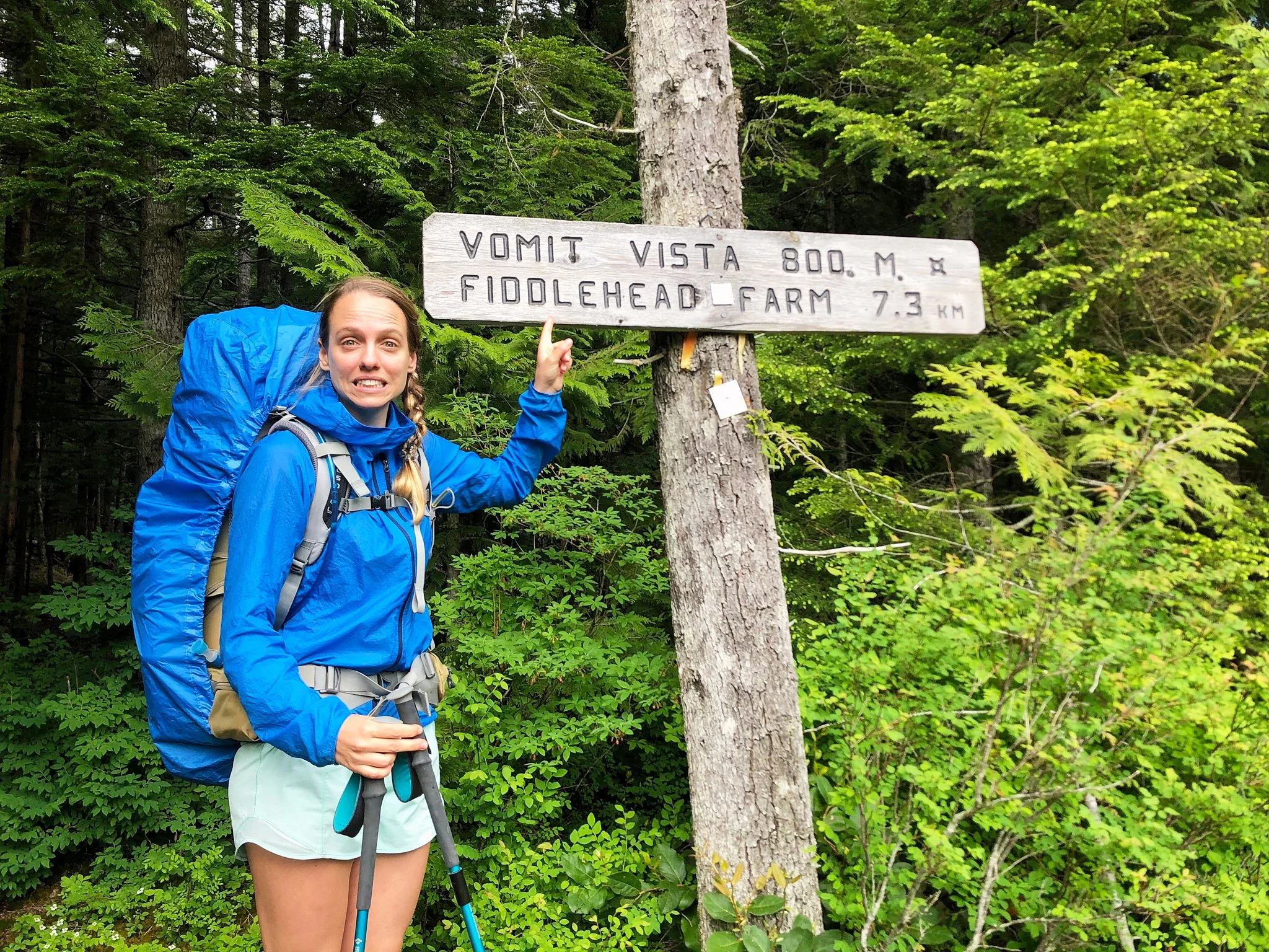
To find the trail, follow the path to the outhouse and then turn right just before you get to the outhouse. You will see a sign for Vomit Vista and Fiddlehead Farm, which is partially blocked by foliage and the outhouse.
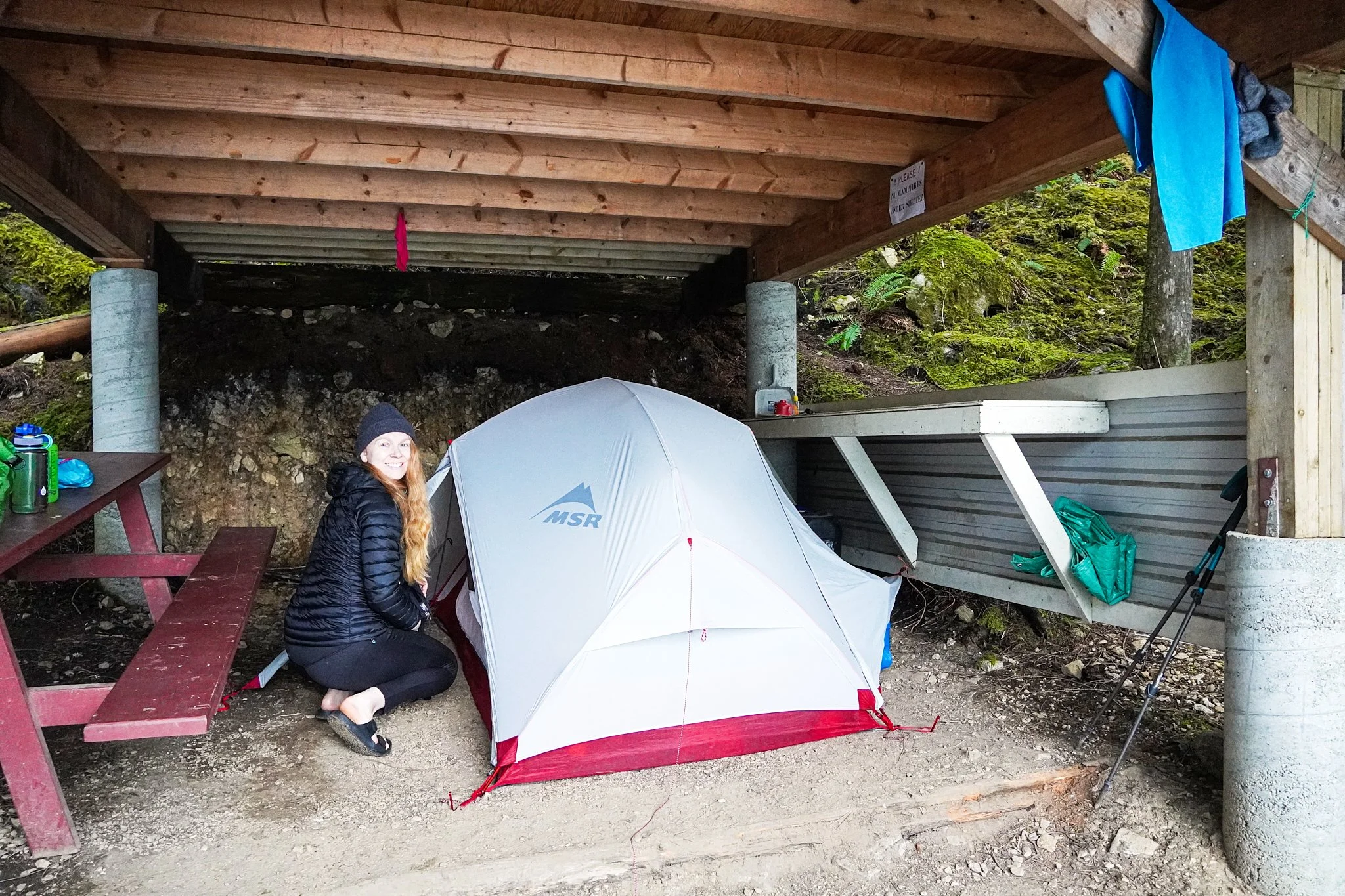
We climbed another 50m to the ridge and then descended down 700m through forest until we reached a logging road. We crossed the road and hiked through a grassy section and then turned left at the fork to get to Fiddlehead Landing (the SCT goes right at this fork). It was another 1-1.5 km to Fiddlehead Landing. The hut here was a bit more rudimentary. We were pleased to realize we could set up under the shelter of the hut for the rainy night to come.
Day 5: Fiddlehead Landing to Lewis Lake 81-94 km (13 km of hiking over 8.5 hours)
We woke up to rain, geared up in all our rain gear and started the slight climb away from the hut. It was 1-1.5 km of relatively flat trail back to the SCT. Another 2 km of hiking through cut blocks. Once through the cut blocks, we had a solid 4 km of climbing with some switchbacks. At this time of year there were lots of water sources! I’m assuming it would dry up quite a bit by the end of summer, so ensure you are carrying enough water to keep yourself hydrated during the 1,000 vertical meters of climbing.
The trail meets an old logging road. This is the final push to the summit. The road turns into a narrower path and when you crest this hill, you will see the hut. Yay! 1,000 vertical meters completed! It was rainy, cloudy and cold.
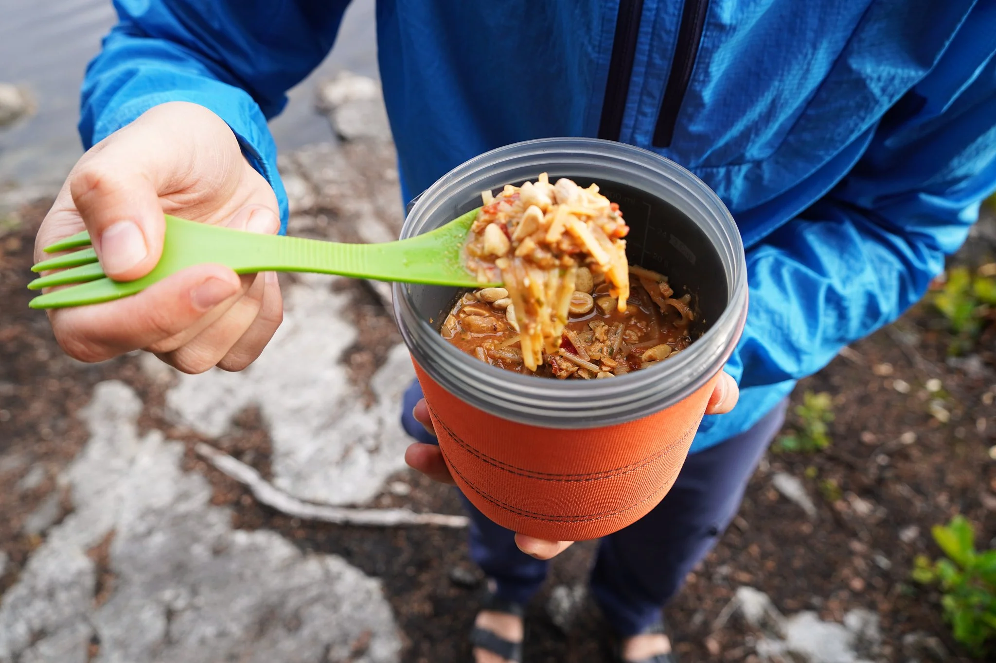
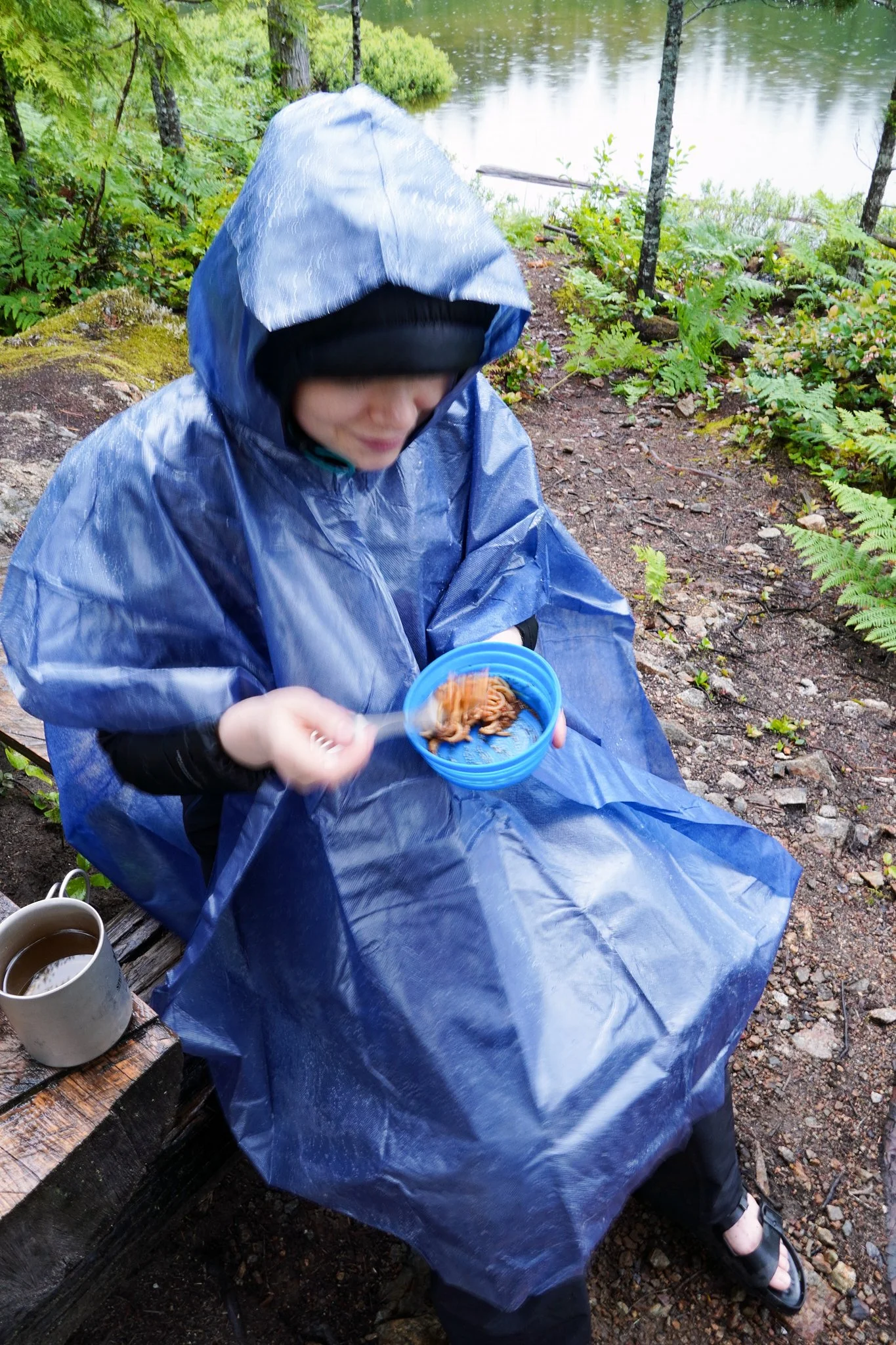
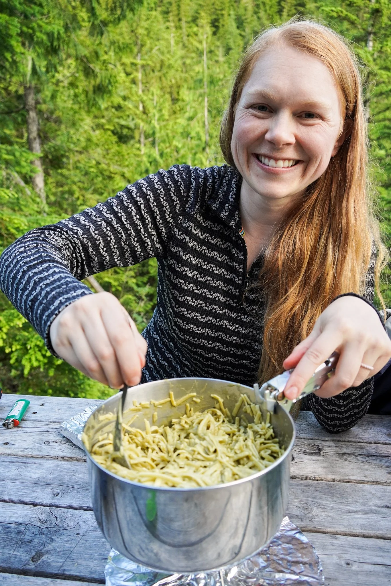
We boiled up water with the Jet Boil for Mr. Noodles. The stove was definitely less efficient at that altitude, but still worked quickly. I added a dry base layer as I was starting to get chilled. We didn’t stop for long. We knew we wanted to push to a lake to camp and hoped the skies would clear.
The initial descent away from the hut is a bit technical and required some scrambling. Eventually the trail is more sheltered by trees and there are some switchbacks. We dropped down off the ridge about 800 vertical meters. We were both incredibly relieved to catch glimpses of Lewis Lake through the trees. We then had to hike a couple kilometers around the East side of the lake until we reached a picnic table, small flat area that could fit 2 tents and an outhouse. We were more than happy to set up for the evening.
It was pouring rain still. We set up quickly, stuffed our dry items inside the tent and then ourselves. We changed into our driest layers and huddled in sleeping bags hoping for the rain to subside.
I was having a moment. My knee was really sore. My sleeping mat and pillow were wet. I was really hungry. I realized it would be easy to lie there feeling sorry for myself. But I needed to eat something substantial and I needed to deal with my period (a separate blog post on how to manage your period in the backcountry coming soon).
Erin was a superstar hiking partner. She realized I needed food. She got out of the tent with me despite the pouring rain and helped me set up the stove. Another 30 minutes and we were eating an early dinner. I was starting to feel better. Oh and the rain was finally starting to subside.
The timing did end up being perfect as we watched a beautiful beaver majestically swim across Lewis Lake.
Day 6: Lewis Lake to Walt Hill 94-122 km (28 km of hiking over 9.5 hours)
We had to pack everything up wet. The trail was undulating to start. After we passed Spring Lake the trail was rerouted due to logging. This meant that the trail no longer goes past March Lake.
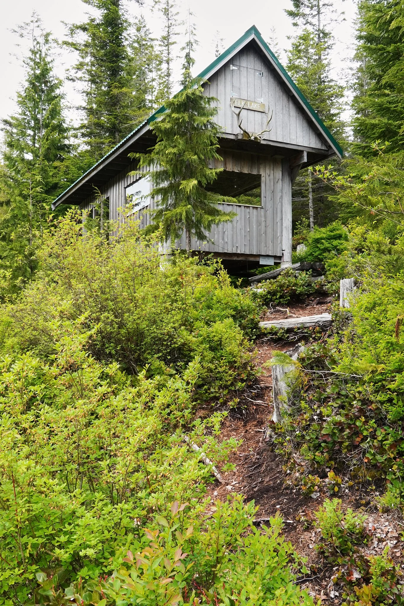
At around 14 km into our day we started the short 150 vertical meter climb to Elk Lake.
The bugs were bad at Elk Lake, probably due to the recent wet weather. We didn’t hangout for long. The hut is really cute and on a sunny day I’m sure would be amazing.
Once we reached the end of Elk Lake, we had a choice of which route to take. We went left at the fork and took the “Outside Route.” Initially, we were really stoked about this choice due to the incredible views we received after very minimal climbing.
We dropped down slightly from this viewpoint onto a deactivated road. This is when we were less stoked about the route choice. We saw a lot of bear scat along this road. Although when discussing this section with other hikers, they also saw a long of bear scat on the other side (inside route?). This was a big challenge mentally for Erin to push through. We did everything we could. Loud music on phone (Drake, naturally), calling out and bear spray at the ready. We were so noisy that we even startled a weasel out of hiding!
The road rejoins to the inside route and we took a left at the fork to hike towards Coyote Lake. At our 20 km mark for the day, we started the 75 m climb to Coyote Lake. Once at the turn off for the lake, we had a snack and discussed options. Although weary, we elected to push to Walt Hill in an attempt to get further out of what seemed to be active bear country. We saw a fresh scat not 2 m away when we started walking again, great call!
We made fast time on this 4 km section of trail leading to the base of Walt Hill. Perhaps it was the escape from bear country, but it also is an easy and cruisey section of trail.
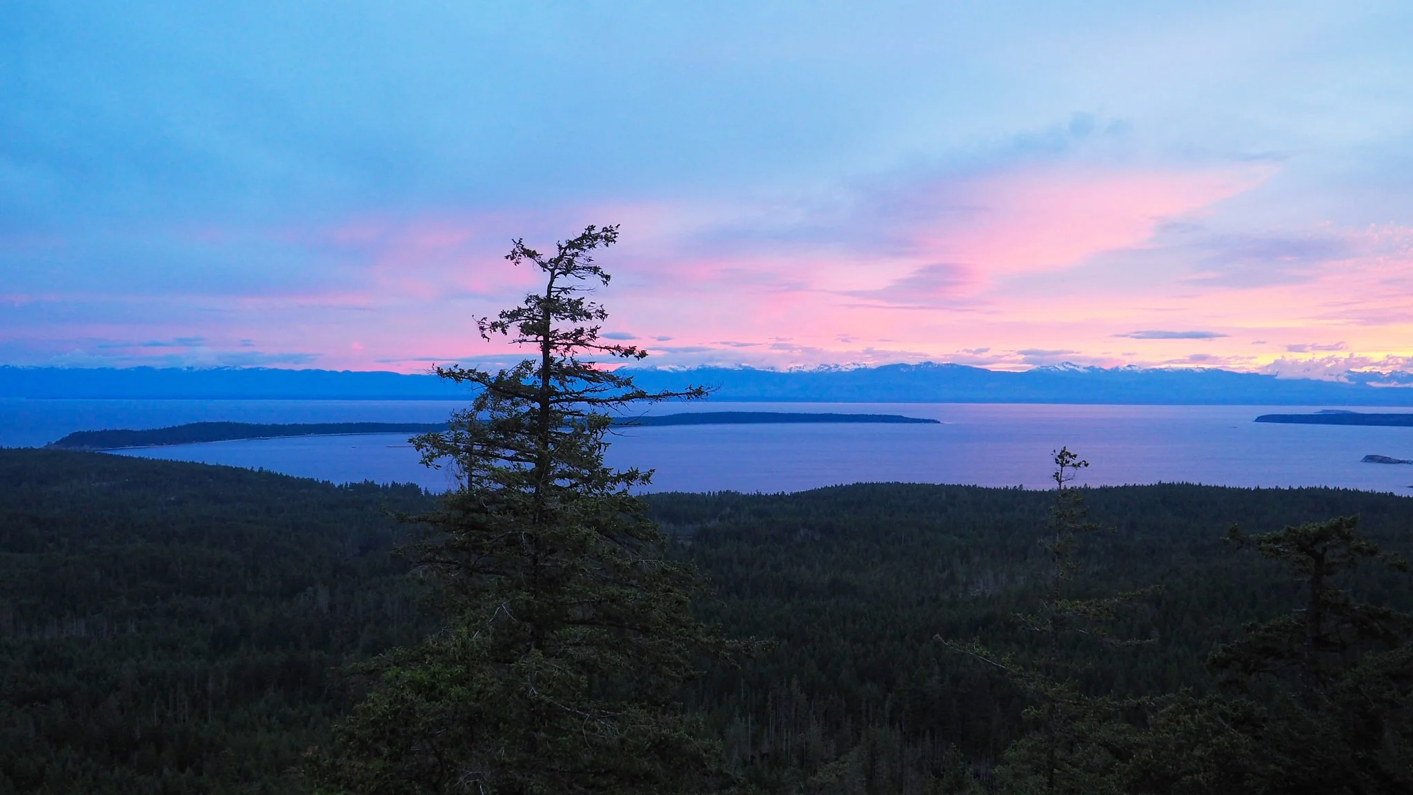
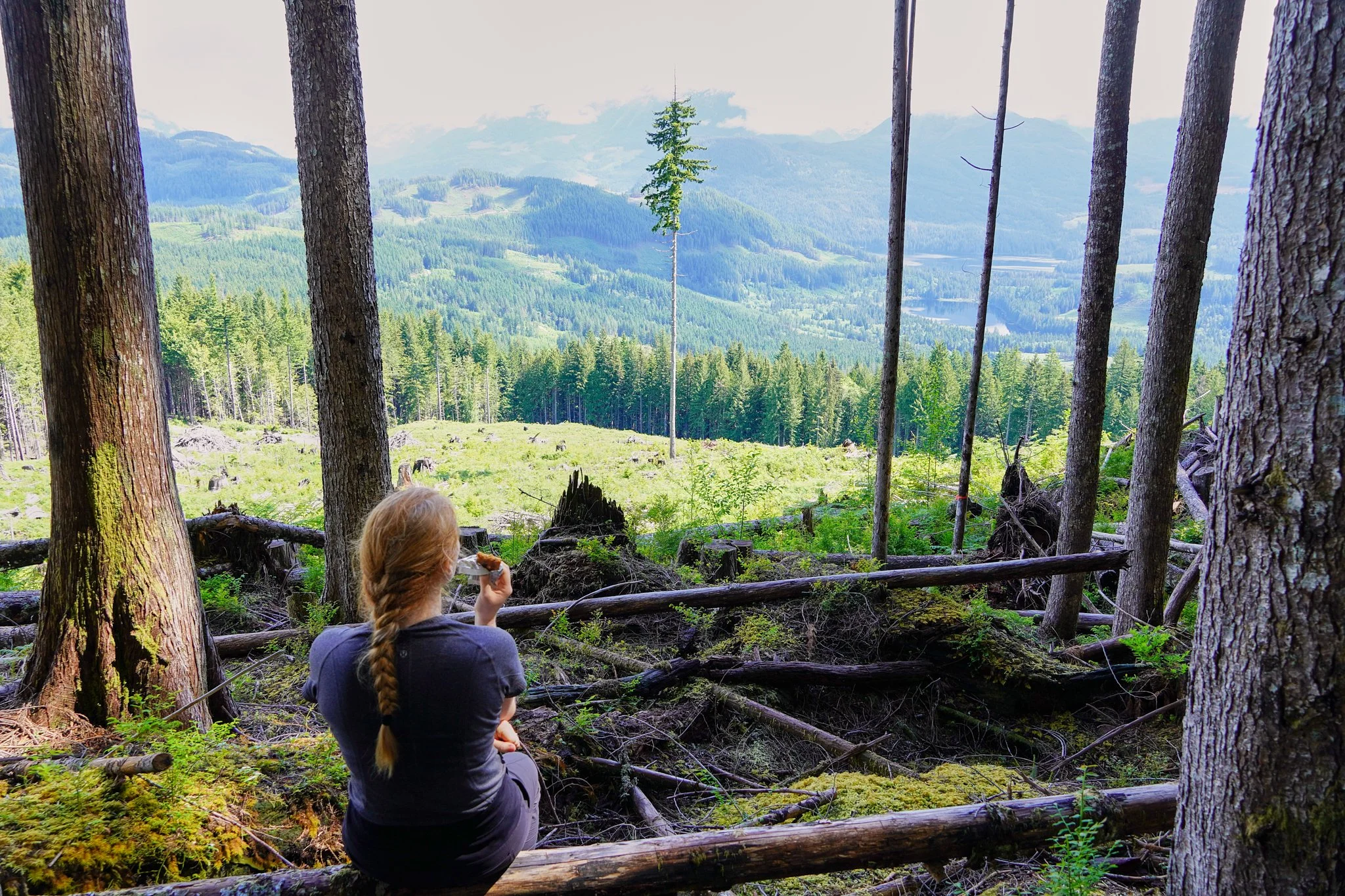
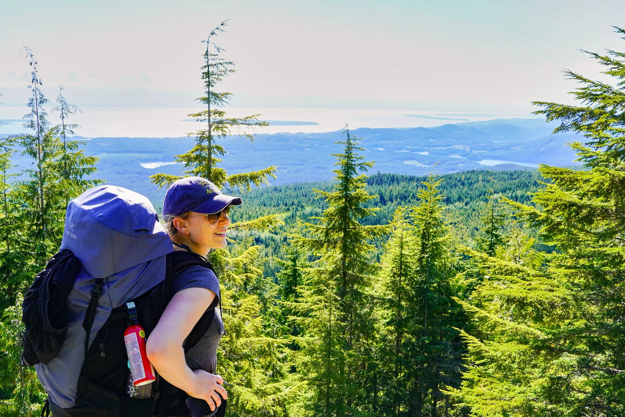
From the base of Walt Hill to the hut is a 200 m climb. We were rewarded with absolutely stunning views of the valley below and the mainland mountains behind. We couldn’t help but stop for some photos.
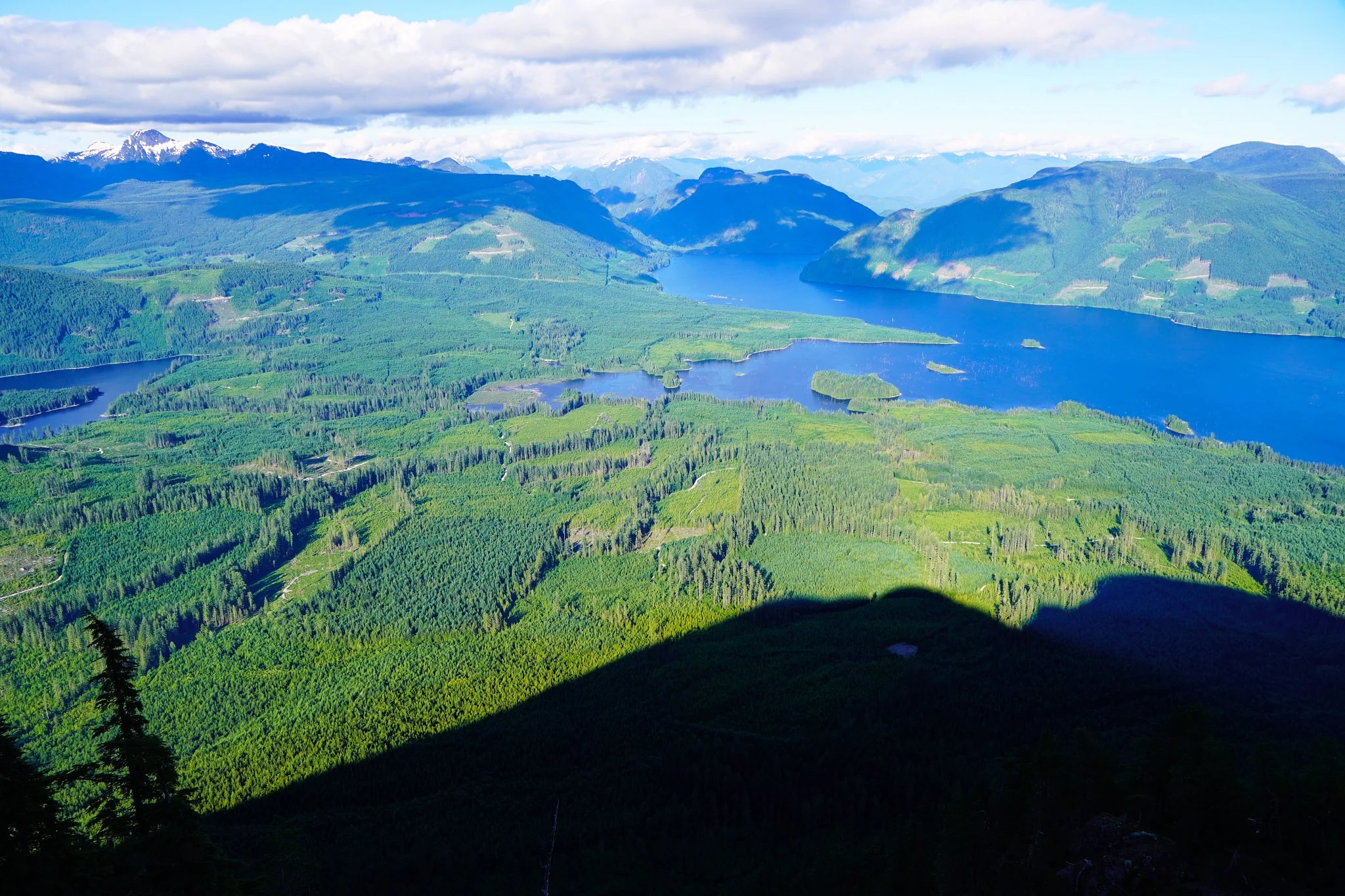
Another km of walking along the ridge brought us to the stunning and empty hut! This was exactly what we both needed. Shelter from wildlife for Erin and sun for drying all of my stuff!!!
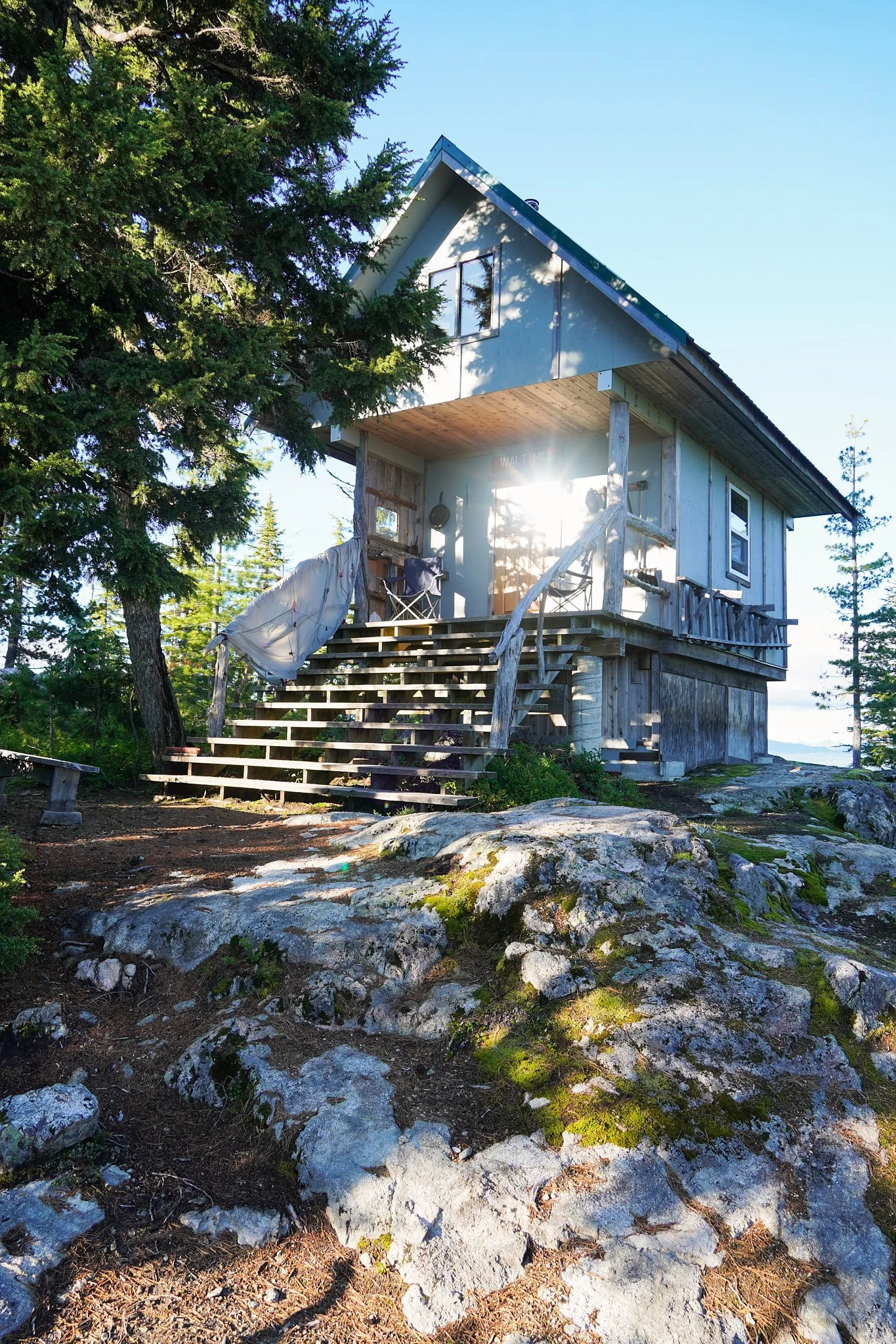
This moment surpassed all the tough moments of the trail. My heart swelled with emotion and gratitude. I thanked my feet for taking me there, I thanked my husband for supporting my outdoor pursuits, I thanked myself for working hard to obtain the gear I needed, I thanked my hiking partner for facing her fears and I thanked Mother Nature for being so beautiful.
Day 7: Walt Hill to Lois Point 122-142 km (20 km of hiking on trail over 5.5 hours) – 8 km off trail to resupply at Lang Bay Store
We were both feeling good for the day ahead. Our packs were light as today was our second resupply day. We dropped down 300 meters on a very straightforward descent.
The next section was quick hiking, relatively flat, in and out of cut blocks. We reached Dixon Road within a couple hours. As luck would have it, we arrived at the road at the same time that the Sunshine Coast Shuttle was dropping off a group of hikers. The driver graciously offered for us to hop in until the end of Dixon Road since he was going that way anyway. This meant we cut 4 km of walking off our day!! Moral was soaring high!
At the Lang Bay store, we both bought chips and cold drinks. I needed nail clippers because my toenails were starting to cut my poor little toes. I bought those and band-aids. After re-packing our bags, we walked up Dixon Road. It only took 45 minutes to do 4 km up the road. We rejoined the trail to the right and met up with Lois River within a couple hundred meters. It was a little bit tricky to find the route across the river; look for the orange markers in the trees.
The trail joins a logging road after crossing Lois River. Turn left on the logging road and then after climbing a short hill, there is another road to the left (there was an open gate on this road). This section isn’t marked! This short section of road leads you to the Lois Dam. If you see the Dam, you’re in the right place. Keep walking all the way to the end of the gravel road and you will spot the first orange marker since before the road section.
You will continue along the shoreline and the trail is well marked again. You pass a noisy Lois Recreation campground which is on your right. This is a car camping spot and likely gets pretty busy. We kept going to the Lois Point camp area. This campsite still looked quite frequented, but we were lucky to only share it with one other party, a thru-hiking couple.
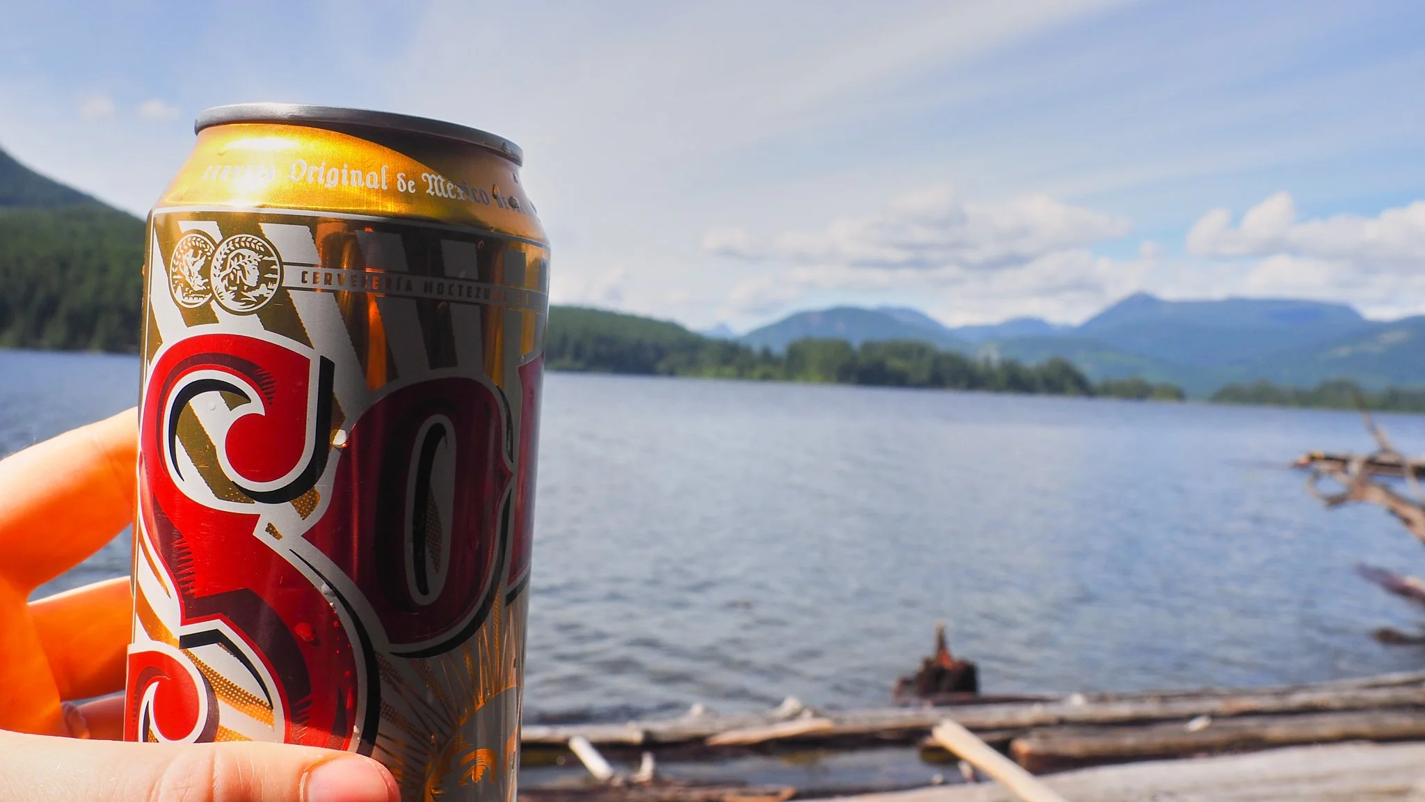
We splurged and carried ourselves in a cider and beer. Lounging on the beach, swimming, eating snacks and drinking a cool drink was a much-needed restful afternoon. We were feeling good.
FYI if you are afraid of spiders, do not use the outhouse here.
Day 8: Lois Point to Rainy Day Lake 142-170 km (28 km of hiking over 8.5 hours)
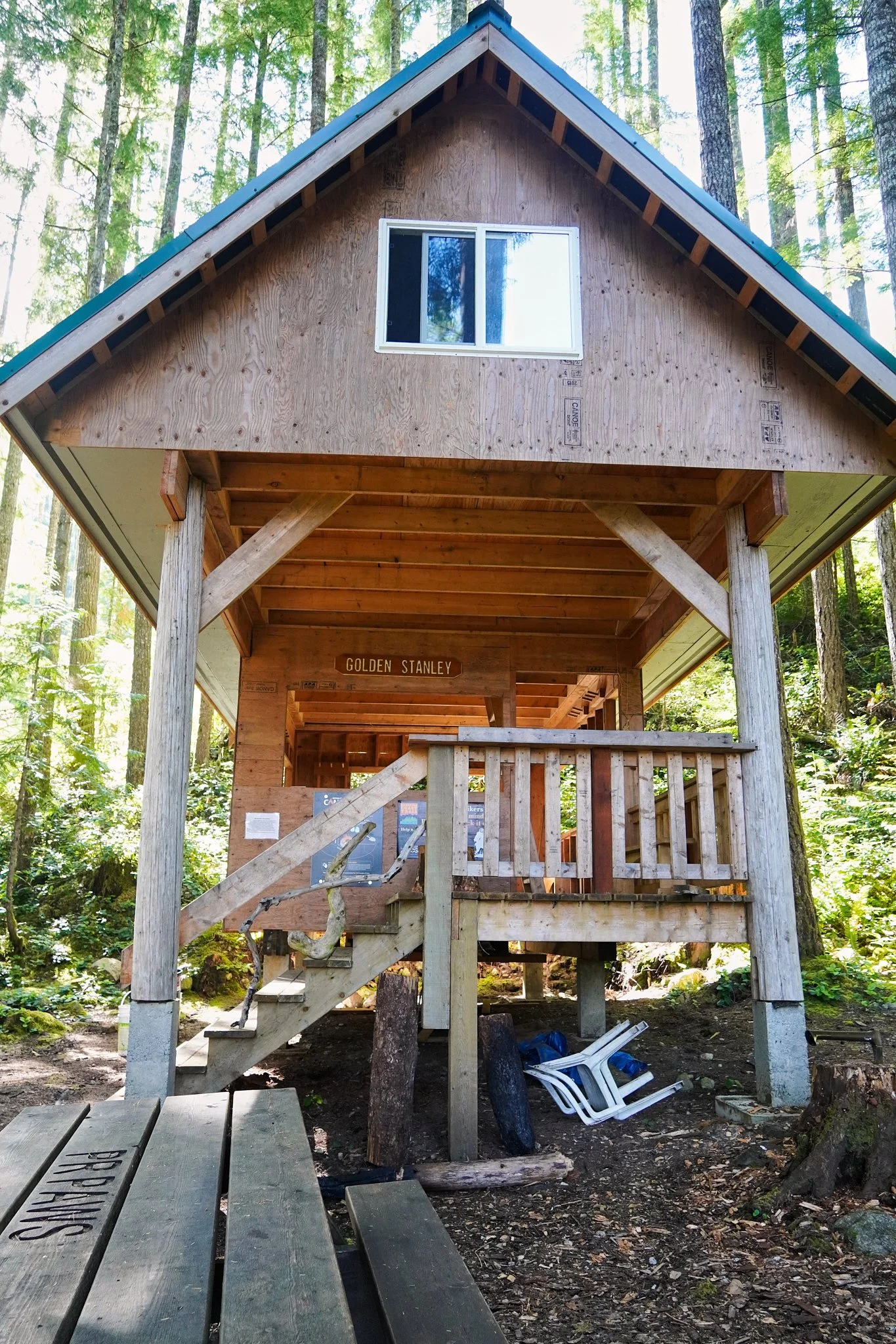
We started off hiking along the shore of Lois Lake which was relatively flat. It was a short climb up to Golden Stanley Hut. We snaked through the forest, climbers right of a cut block until we reached the hut. This is a stunning hut with a beautiful rushing river nearby that I’m sure would lull you to sleep. It seemed like there were very few spots for tents at this hut, so keep that in mind when planning.
Above the hut we climbed steadily through the trees. The trail punches out onto an old road. The climb becomes gradual here. There is another short climb through the trees for a final push up to Elephant Lake. We stopped for lunch, but never found an obvious camping spot. The small flies were awful, so we didn’t stop for long.
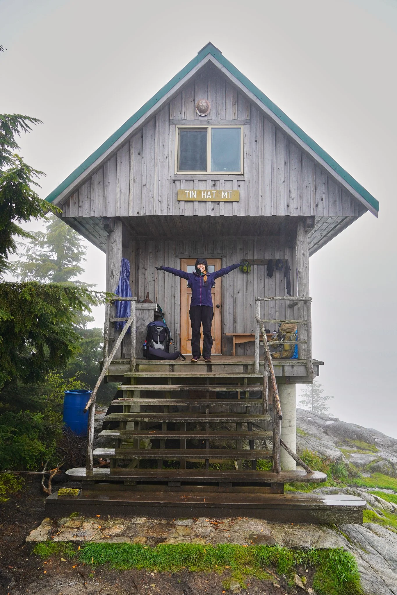
We pushed to the hut on Mount Troubridge which is at 1,175m. The hut isn’t at the top of the mountain and it’s situated beside a small pond for a water source. A group of 6 hikers were staying at the hut. Due to the number of flies continuing to swarm us, we decided to skip our planned night here and push on to Rainy Day Lake.
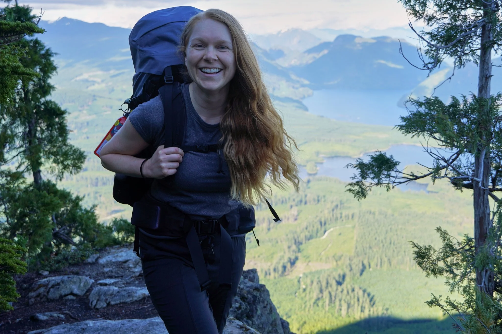
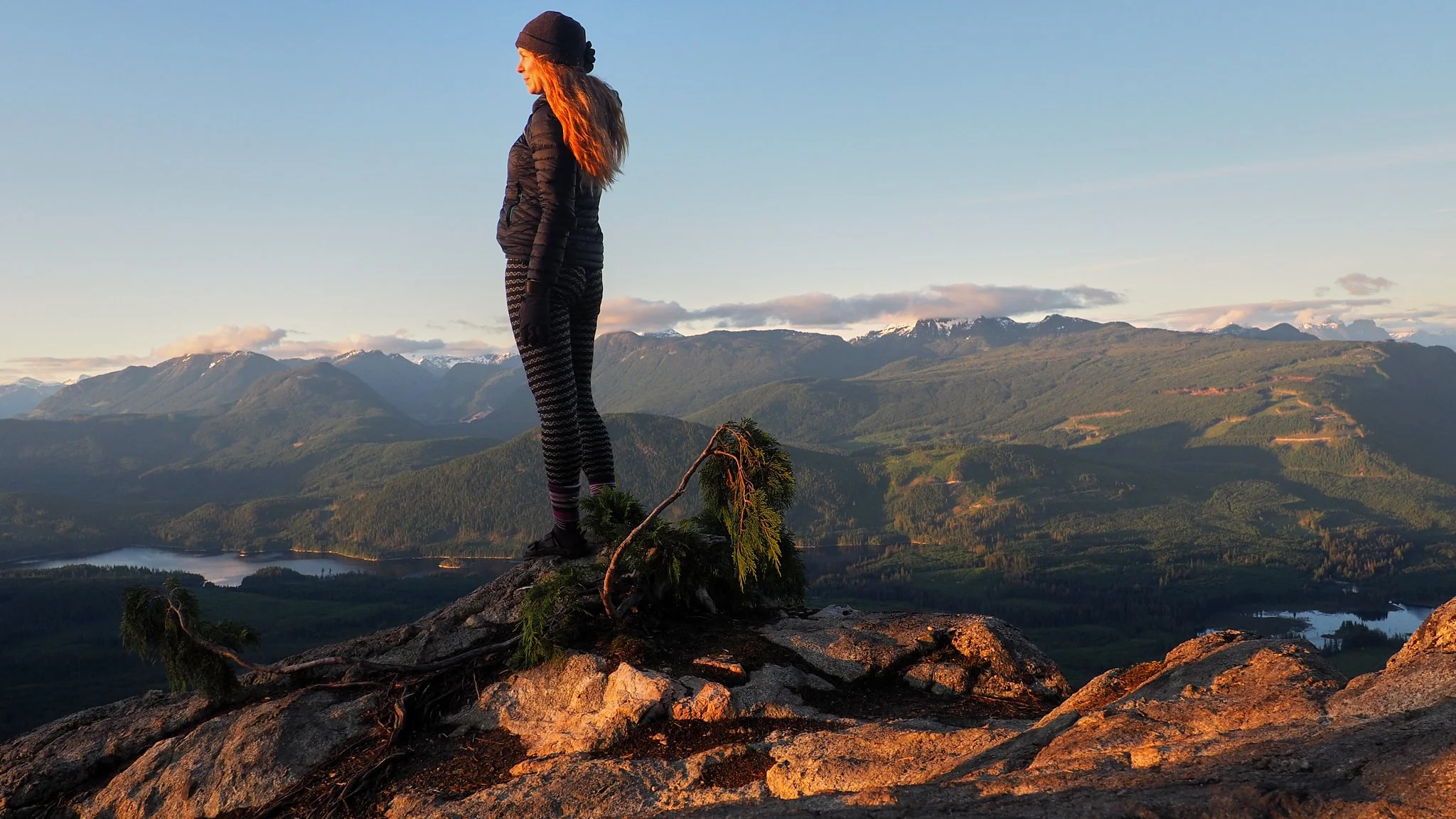
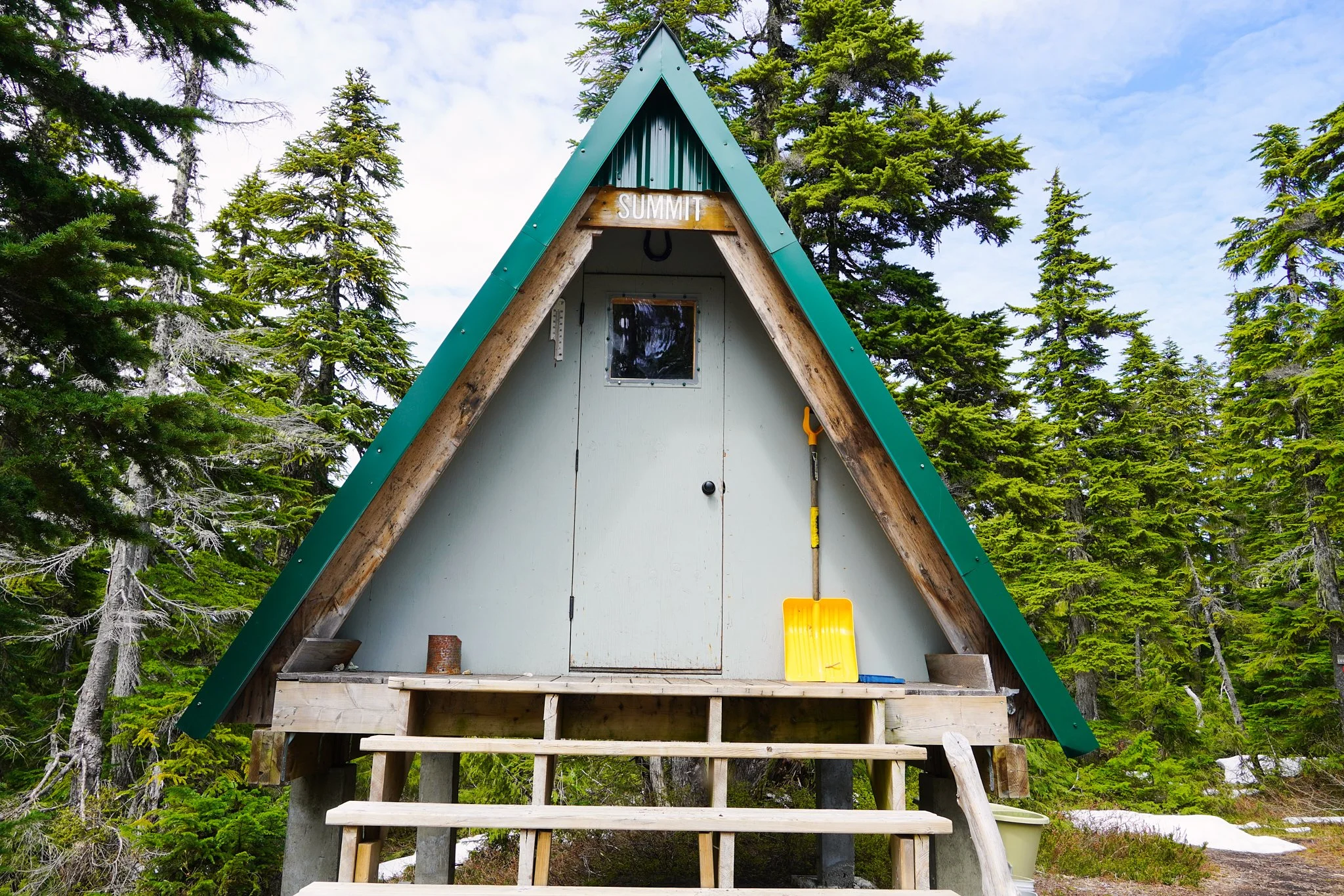
Another 100 vertical meters and we were at the summit! The views were absolutely breathtaking!!! There is an emergency shelter at the summit.
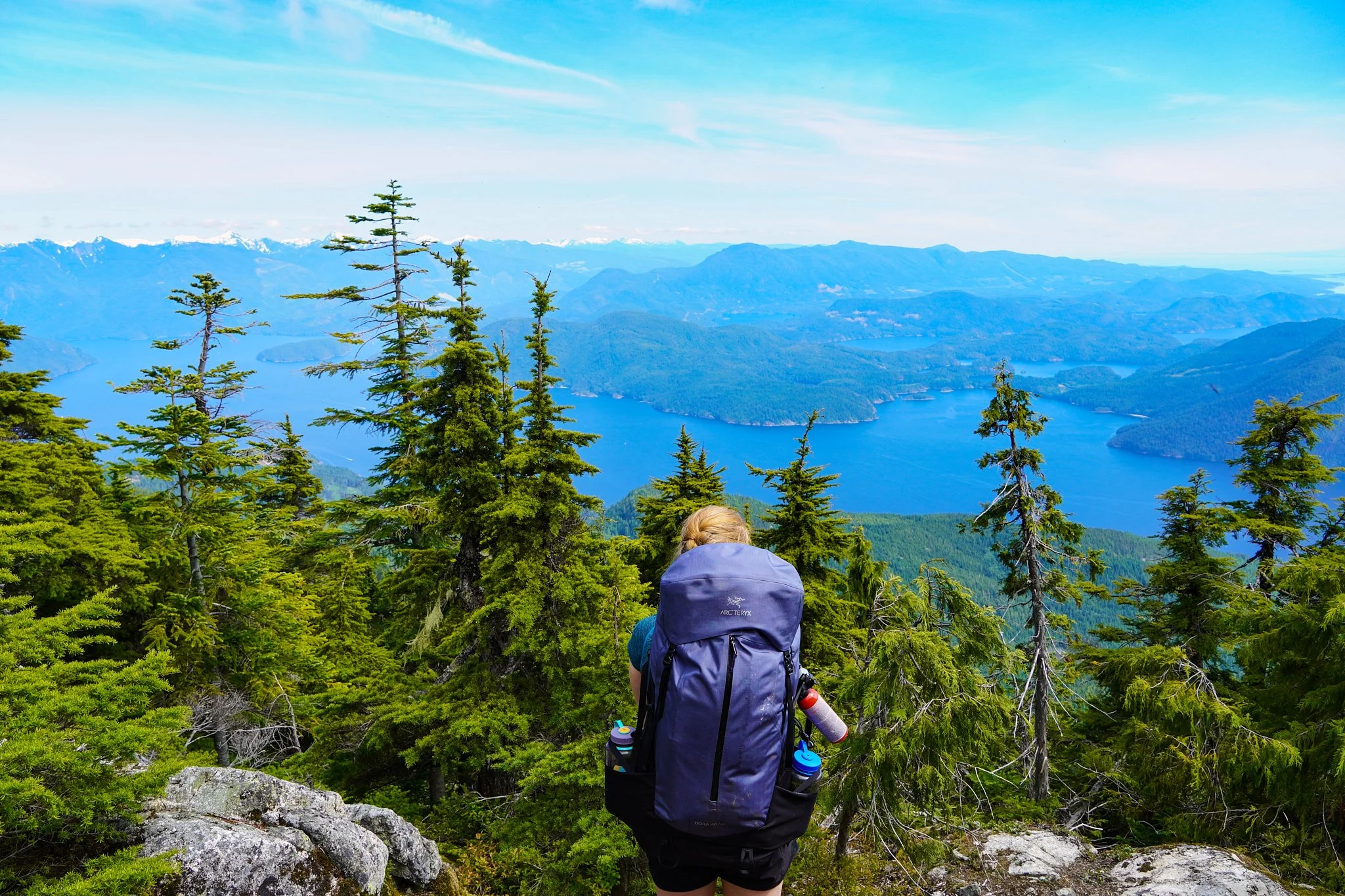
We dropped down along a ridge off the other side of Troubridge and the views continued to amaze us. Approximately 90% of the descent was on trail until we reached a road. We walked the road for less than a km then rejoined a trail which dropped us down to the Rainy Day Lake Hut.
Upon first impression, it’s not clear that you can access the lake from the hut. However, there is a trail that starts at the end of the hut closest to the lake that you can take down to a beautiful dock for swimming. Diving into the lake was absolutely incredible after a long day of hiking.
There were 5 other hikers staying at the hut and they very generously shared some rum and coke with us. It really started to sink in how close we were to completing our huge goal.
Day 9: Rainy Day Lake around to Fairview Hut and then THE END! 170-178 km (13 km of hiking over 3 hours)
We decided to take the oceanside route which passes the Fairview Hut. We climbed 100 vertical meters above Rainy Day Lake hut over 1-2 km and then dropped down to sea level.
The Fairview Hut is less than 1 km along the trail once you reach the sea. Where the hut is situated was magic. The sun was out, the breeze was sweet, and the views were rewarding. I started to realize I didn’t want the trail to end.
This well-maintained section of trail follows along the edge of the shore with a few small ups and downs. With 3 kms left on the trail, we had to climb away from sea level and then drop back down. We could see the ferry terminal at this point, indicating just how close we were to finishing! Our pace picked up as we climbed the final 1 km along the logging road to the official end of the SCT.
The car was still there in the paid parking lot! We were absolutely stoked to be finished!!
This was the longest hike that both Erin and I had ever done. It wasn’t without it challenges. However, this is a great starter thru-hike if you have bigger thru-hikes in mind. Navigation was really straightforward, most of the trail is well maintained, there are lots of access points to the trail, there are ample huts along the way, and the terrain isn’t as challenging as alpine.
When I first hiked the northern 50 km section of the trail I thought how cool it would be to one day hike the entire thing. I honestly didn’t think I would ever have the time or skills to do so. But I DID IT! So, my message to you is, don’t limit yourself. Do the work and take the time to get to your goal, but don’t give up just because you think it’s too hard. I started with day hikes. Now I can say I thru-hiked a 178 km trail in 9 days. That’s pretty badass.
Gear Used on this Thru-Hike
Stove: Jet Boil
Tent: MSR Hubba Hubba
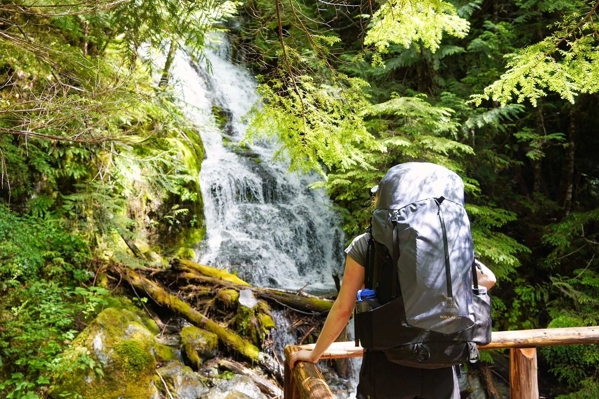
Pack: Arc’teryx Bora AR 61 Backpack Women’s
Hiking Shoes: Salomon Women’s Outbound Hiking Shoes
Sleeping Pads: Therm-a-Rest NeoAir XTherm MAX Ultralight
Jackets: Montane Women’s Phoenix Jacket (puffy) and Montane Women’s Alpine Pro Jacket (rain jacket)